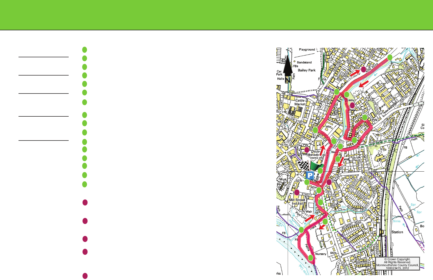
Swan Meadows and the River Gavenny
From car park, turn left on Monmouth Road and then left again into Swan Meadows.
Walk through the meadows
Turn left through the gate on Lower Monk Street
Turn right on Ross Road
Turn into the gardens and follow the river bank to the top
Double back to the Ross Road entrance
Cross the bridge, take the path uphill to the right, pass the children’s playground and follow the path behind the
houses
Go through the alley and turn left on Ostringen Close
Turn right on Gavenny Way and right again at the T junction and follow this road down the hill towards town
After the roundabout, cross the road and go through the metal gate
Cross the meadow and follow the path through trees along the riverbank back to Monmouth Road
Cross Monmouth road with caution (there is a pelican crossing 25m to the right)
Take the first right then first left, following the crescent back to the Monmouth Road
Turn right here following a lane down to Castle Meadow
Walk round the outside of the meadow
Retrace your route up the lane, along the crescent and along Monmouth Road back to the Bus Station Car Park
POINTS OF INTEREST
Abergavenny meaning mouth of the River Gavenny is situated at the confluence of the rivers Gavenny and
Usk
The standing stones in Swan Meadow were erected in 2009 as part of a local history society project to
highlight Abergavenny’s importance in the eistoddfod tradition in Wales
There’s a good example of a recently ‘laid’ hedge in the upper Gavenny medow
From 1851 the Monmouthshire Lunatic Asylum, later Pen-y-Fal Hospital, a psychiatric hospital stood on the
outskirts of Abergavenny. Between 1851 and 1950 over 3,000 patients died at the hospital and were buried
in the Pen-y-Fal cemetery. A memorial plaque for the deceased has now been placed at the site (Have Pic)
The woodland path on the east bank opposite Swan meadow is a good place to see and hear woodland
birds throughout the year
DISTANCE
2.7 miles / 4.3 kilometres
TIME
75 mins
GRADE
Dicult with a sustained
ascent and steep descent
STARTING POINT
Bus station car park
This route information has been
prepared by Monmouthshire
County Council Countryside
Services with support from the
countryside Council for Wales.
THE ROUTE
1
A
2
3
4
5
6
7
8
9
10
11
12
13
14
15
16
B
C
D
E
1
A
2
3
4
5
6
7
8
9
10
11
12
13
14
15
16
B
C
D
E
