Joint City-County
Comprehensive Plan Update 2007-2027
Partial Plan Update
For Catoosa County and the Cities of Fort
Oglethorpe and Ringgold
October 2007
Prepared by the Coosa Valley Regional Development Center
2
For More Information on this Plan Update, Contact:
Catoosa County Board of Commissioners Chairman Bill Clark
City of Fort Oglethorpe City Manager Ronald C. Goulart
City of Ringgold City Manager Dan Wright
To obtain a copy of this plan update, contact:
Coosa Valley Regional Development Center
P.O. Box 1798
Rome, GA 31062-1798
(706) 295-6485
3
Table of Contents
Introduction & Methodology …….……………………………………… 4
Narrative for Catoosa County
Quality Community Objectives Assessment ……………………….. 6
Areas Requiring Special Attention Evaluation and Map…………… 14
Issues and Opportunities ……………………………………………… 18
Short Term Work Program ...………………………………………….. 24
Report of Accomplishments …………………………………….…….. 30
Narrative for City of Fort Oglethorpe
Quality Community Objectives Assessment ………………………… 34
Areas Requiring Special Attention and Character Area
Identification / Map……….....………………………………………….. 41
Issues and Opportunities ………………………………………………. 53
Short Term Work Program …………………………………………….. 61
Report of Accomplishments ……………………………………………. 72
Narrative for City of Ringgold
Quality Community Objectives Assessment ………………………… 81
Areas Requiring Special Attention Evaluation……………………….. 85
Areas Requiring Special Attention Map ………………………………. 91
Issues and Opportunities ………………………………………………. 92
Short Term Work Program …………………………………………….. 112
Report of Accomplishments ……………………………………………. 118
Appendix A
4
Introduction
The State of Georgia requires that local governments update their
comprehensive plan to maintain Qualified Local Government Status. Current
Department of Community Affairs requirements call for a partial update, the
Community Agenda, to be submitted by the recertification date. To that end, the
local governments of Catoosa County and the cities of Fort Oglethorpe and
Ringgold worked with the Coosa Valley Regional Development Center to identify
stakeholders, gather community input, and complete the requirements of the
partial update.
Methodology
Stakeholder Involvement
The joint comprehensive plan update process allows for stakeholder input
and community participation. Stakeholders for Catoosa County and the cities of
Fort Oglethorpe and Ringgold were identified. Local government officials and
staff worked to identify issues and opportunities, and assess quality community
objectives. Each local government was asked for a list of stakeholders to include
in the planning process.
They included but were not limited to members of city councils and county
commissions, city and county staff, development authority members, chambers
of c
ommerce, media, community members, churches and religious organizations,
housing authority directors, librari
es, civic organizations, county and city planning
commissions, civic and garden clubs, E-911 and emergency personnel, and any
other interested parties.
All stakeholders received invitations to the planning meetings, the short-
term work program workshops, and public hearings. Public hearings were
advertised to the community at large in accordance with requirements.
Gathering community input through a Visioning Survey
The local governments of Fort Oglethorpe and Ringgold invited the public
to share growth concerns using a survey advertised in local newspapers,
distributed to stakeholders, made available to the public at city halls, county
government buildings, public works offices, libraries, planning offices, technical
colleges, chambers of commerce, nutrition centers, housing authorities, and on
request from the Coosa Valley Regional Development Center.
Survey questions included location of home and work, reason for living in
the community, what was liked and disliked about the community, overall
perception of the community and region, perception of growth and changes,
perception of services provided, a ranking of growth management concerns, and
perceptions of growth management actions.
5
CATOOSA COUNTY

6
Catoosa County - Quality Community Objectives Assessment
In 1999 the board of the Department of Community Affairs adopted the Quality
Community Objectives (QCO’s) as a statement of the development patterns and
options that will help Georgia preserve its unique cultural, natural and historic
resources while looking to the future and developing to its fullest potential. The
Assessment is meant to give the community an idea of how it is progressing with
respect to these objectives. The assessment is a tool for use at the beginning of
the comprehensive planning process where the community is asked to examine
a series of yes/no statements regarding local ordinances, policies, and
organizational strategies intended to create and expand quality growth principles.
Below is a summary of the results of the Quality Community Objectives
Assessment.
Development Patterns
Traditional neighborhoods
Traditional neighborhood development patterns should be encouraged; including
use of more human scale development, compact development, mixing of uses
within easy walking distance of one another, and facilitating pedestrian activity.
Currently, children do not bike to school
Schools are not necessarily located in or near neighborhoods in our
community.
The unincorporated areas of the County are growing yet there remains
much space between areas to the extent that walking or biking do not
appear to be appropriate transportation alternatives in terms of comfort or
safety. The County has been urbanizing very quickly and is dominated by
automobile travel. Road improvements are planned to reduce congestion
but will probably not address walkability factors. We would rely on the
more compact areas within the municipalities (Cities of Fort Oglethorpe
and Ringgold) for walking and biking opportunities.
We currently do not have a street tree ordinance requiring new
development to plant shade-bearing trees appropriate to our climate.
The County will consider drafting a tree replacement ordinance.

7
Development Patterns (cont.)
Infill development:
Communities should maximize the use of existing infrastructure and minimize
the conversion of undeveloped land at the urban periphery by encouraging
development or redevelopment of sites closer to the downtown or traditional
urban core of the community.
Some areas of the community are planned for nodal development, i.e.
compacted near intersections, although much development occurs
along our major roads.
Sense of Place:
Traditional downtown areas should be maintained as the focal point of the
community or, for newer areas where this is not possible, the development of
activity centers that serve as community focal points should be encouraged.
These community focal points should be attractive, mixed-use, pedestrian-
friendly places where people choose to gather for shopping, dining, socializing,
and entertainment.
If someone dropped from the sky into our community, he or she would
know immediately where he or she was, based on our distinct
characteristics.
We have delineated the areas of our community that are important to
our history and heritage. While not currently mapped, the community
knows where these areas are. Many of those areas and properties are
privately owned. Those owners have not been motivated to sell,
thereby limiting the community’s ability to preserve them. The County
would like to work towards a right of first refusal as historic properties
come up for sale.
Our Historic Preservation Commission has been newly created and will
assume the task of continuing to explore locations for placement on the
National Register of Historic Places.
We have no façade restrictions or ordinances to regulate the
aesthetics of development in our highly visible areas.
The County will be working on several ordinances to address the
aesthetics of development through ridgeline development ordinances and
conservation subdivision ordinances. There are a lot of ideas being
discussed.
We have ordinances to regulate the size and type of signage in our
community, though the billboard ordinance could be strengthened.
We do not offer a development guidebook that illustrates the type of
new development we want in our community.

8
Development Patterns (cont.)
The 20/20 Committee will work with the County on a guidebook that will
include subdivision regulations.
Transportation Alternatives:
Alternatives to transportation by automobile, including mass transit, bicycle
routes, and pedestrian facilities, should be made available in each community.
Greater use of alternate transportation should be encouraged.
We have limited options for alternatives to automobile transportation in
our community. Currently projects involving bike routes are not
deemed a priority in Catoosa County, though we would like to see
user-friendly sidewalks required of new development.
Regional identity:
Each region should promote and preserve a regional “identity”, or regional sense
of place, defined in terms of traditional architecture, common economic linkages
that bind the region together, or other shared characteristics.
Our community does not necessarily encourage businesses that create
products that draw on our regional heritage (mountain, agricultural,
metropolitan, coastal, etc.)
Our community has begun to promote tourism opportunities based on
the unique characteristics of our region.
The community has identified many opportunities for tourism including
increased focus on the Chattanooga and Chickamauga Military Park. The
year 2010 will feature an anniversary of the Civil War and provide many
opportunities. A driving tour is being developed for the County complete
with brochure identifying areas of interest such as Barnhart Circle,
Cherokee Springs, The Old Stone Church, and T.C. Napiers’ Country
Store as well as others.
Our community contributes to the region, and draws from the region,
as a source of local culture, commerce, entertainment and education.

9
Resource Conservation
Heritage preservation :
The traditional character of the community should be maintained through
preserving and revitalizing historic areas of the community, encouraging new
development that is compatible with the traditional features of the community,
and protecting other scenic or natural features that are important to defining the
community’s character
Our Historical Society has been relatively inactive in our concentration
on new development. Discussion of suitable locations for a Museum
showcasing the County’s history would enhance heritage preservation
as well as tourism potential.
We lack ordinances to ensure that new development will complement
our historic development.
We need ordinances to protect “The Gap”
Open space preservation:
New development should be designed to minimize the amount of land
consumed, and open space should be set aside from development for use as
public parks or as greenbelts/wildlife corridors. Compact development
ordinances are one way of encouraging this type of open space preservation.
Catoosa County is developing conservation subdivision ordinances,
considering setting a minimum of twelve houses and encouraging
protection for natural amenities within the development, i.e. setting
aside a certain percentage of greenspace.
A pre-submittal process is being discussed to facilitate communication
between developers and the County around the implementation of
conservation subdivision ordinances.
Environmental protection:
Environmentally sensitive areas should be protected from negative impacts of
development, particularly when they are important for maintaining traditional
character or quality of life of the community or region. Whenever possible, the
natural terrain, drainage, and vegetation of an area should be preserved.
Our community has a comprehensive natural resources inventory
including wetlands, groundwater recharge zones, water resources, and
areas of high, medium, or low sensitivity to development pressures.
These areas are mapped and provide guidance to the County Health
Department in issuing of permits for septic tank siting and permitting.

10
Resource Conservation (cont.)
Environmental Protection:
We use this resource inventory to steer development away from
environmentally sensitive areas
Our community has passed the necessary Part V environmental
ordinances and we enforce them.
Our community will be drafting tree preservation and tree-replanting
ordinances to apply to new development.
We are using stormwater best management practices for all new
development.
We have land use measures that will protect the natural resources in
our community.
Social and Economic Development
Growth Preparedness:
Each community should identify and put in place the pre-requisites for the type of
growth it seeks to achieve. These might include infrastructure (roads, water,
sewer) to support new growth, appropriate training of the workforce, ordinances
and regulations to manage growth as desired, or leadership capable responding
to growth opportunities and managing new growth when it occurs.
We have population projections for the next 20 years that we refer to
when making infrastructure decisions.
The impact fee study conducted in 2005 guides our capital improvements
Our local governments, the local school board, and other decision-
making entities use the same population projections.
Commissioners understand the land-development process in our
community.
We periodically review our development regulations and/or zoning
code, and believe that our ordinances, with minor modifications will
help us achieve our QCO goals.
We have a Capital Improvements Program that supports current and
future growth.
We have designated areas of our community where we would like to
see growth, however the Comprehensive Land Use Map is not based
on natural resource factors.
We have clearly understandable guidelines for new development.

11
Social and Economic Development (cont.)
We have a citizen-education campaign through the Kiwanis Club,
Chamber of Commerce and other entities allowing all interested parties
to learn about development processes in our community.
We have procedures in place that make it easy for the public to stay
informed about land use issues, zoning decisions, and proposed new
development. Information is posted at government buildings and
advertised in the local newspaper.
We do have a public-awareness element in our comprehensive
planning process.
Appropriate businesses :
The businesses and industries encouraged to develop or expand in a community
should be suitable for the community in terms of job skills required, long-term
sustainability, linkages to other economic activities in the region, impact on the
resources of the area, and future prospects for expansion and creation of higher-
skilled job opportunities.
Our economic development organization has considered our
community’s strengths, assets and weaknesses, and has created a
business development strategy based on them.
Data suggests that 80% of growth in local economies will involve existing
industry.
We do not currently have a comprehensive plan to recruit compatible
business or industry.
We have a diverse jobs base, so that one employer leaving would not
cripple our economy.
Employment options:
A range of job types should be provided in each community to meet the diverse
needs of the local workforce.
Our economic development program does have an entrepreneur
support program through organizations such as the Northwest Georgia
Joint Development Authority (NWGJDA).
The County has been designated as “entrepreneur friendly” by the
Georgia Department of Economic Development.
Our community has jobs for skilled labor
Our community has jobs for unskilled labor.
Our community does have professional and managerial jobs.

12
Social and Economic Development (cont.)
Housing choices:
A range of housing size, cost, and density should be provided in each
community to make it possible for all who work in the community to also live in
the community (thereby reducing commuting distances), to promote a mixture of
income and age groups in each community, and to provide a range of housing
choice to meet market needs.
Our community allows accessory units like garage apartments or
mother-in-law units.
People who work in our community can also afford to live in the
community.
Our community has enough housing for each income level (low,
moderate and above-average)
We encourage new residential development to follow the pattern of our
original town, continuing the existing street design and maintaining
small setbacks.
Our community does not currently have options available for loft living,
downtown living, or “neo-traditional” development. These options are
perhaps more appropriate in the urbanized area within city limits where
there is greater density.
We have vacant and developable land for multifamily housing.
We want to discourage the development of multifamily housing in our
community.
We no longer have housing being built for lower-income households.
Our community is slightly more affluent than surrounding communities
so there is very little demand. Similarly the case with housing
programs for households with special needs.
We do not allow small houses to be built on small lots (less than 5,000
square feet) in any areas.
Educational Opportunities:
Educational and training opportunities should be readily available in each
community – to permit community residents to improve their job skills, adapt to
technological advances, or to pursue entrepreneurial ambitions.
Our community provides workforce training options for its citizens
through our Learning Center and Northwestern Technical College.
Our workforce training programs provide citizens with skills for jobs
that are available in our community. The Learning Center provides
these opportunities as well as training at the hospitals.
Our community has higher education opportunities close by through
Dalton State College and University of Tennessee at Chattanooga.

13
Social and Economic Development (cont.)
Educational Opportunities:
Our community has many job opportunities for college graduates
throughout the Tri-State area (Georgia, Alabama, and Tennessee), so
that our children may live and work here if they choose.
Governmental Relations
Regional Solutions:
Regional solutions to needs shared by more than one local jurisdiction are
preferable to separate local approaches, particularly where this will result in
greater efficiency and less cost to the taxpayer.
We participate in regional economic development organizations,
Northwest Georgia Joint Development Authority (NWGJDA),
Chattanooga-Hamilton County North Georgia Area Transportation
Planning District (CHCNGA).
We participate in regional environmental organizations and initiatives,
especially regarding water quality and quantity issues.
We work with other local governments to provide or share appropriate
services, such as public transit, libraries, special education, tourism,
parks and recreation, emergency response, E-911, homeland security,
etc.
Our community thinks regionally, especially in terms of issues like land
use, transportation and housing, understanding that these go beyond
local government borders.
Regional Cooperation:
Regional cooperation should be encouraged in setting priorities, identifying
shared needs, and finding collaborative solutions, particularly where it is critical
to success of a venture, such as protection of shared natural resources or
development of a transportation network.
We plan jointly with our cities and county for comprehensive planning
purposes.
The Service Delivery Strategy is continually evaluated.
We initiate contact with other local governments and institutions in our
region in order to find solutions to common problems, or to craft
regionwide strategies.
We meet regularly with neighboring jurisdictions to maintain contact,
build connections, and discuss issues of regional concern.
14
Catoosa County / Areas Requiring Special Attention
Severe slopes
Development on steep slopes accelerates water runoff and provokes subsequent
erosion in the watershed, leading ultimately to challenges to water quality.
Development of brow areas affects the viewshed, a major natural resource
contributing to quality of life in the County. Viewsheds will be protected using
such tools as conservation easements, greenspace minimum requirements in
regulations, etc. Steep slopes will be protected from erosion with stricter
enforcement of erosion and sedimentation regulations and stormwater
regulations. The County is engaged in discussion of specifics regarding
ordinances to help with brow protection. County-wide sign regulations to be
coordinated with zoning districts and based on traffic speed, volume, and type of
road will help protect mountain scenery.
Steep slopes in the County extend north and south along White Oak Mountain,
east of the City of Ringgold and Taylor’s Ridge to the south in the Chattahoochee
National Forest. There are approximately 25,270 acres of steep slopes scattered
throughout the County. Further west along Peavine Ridge and Boynton Ridge,
the terrain becomes more rolling hills with steep slopes interspersed in the
characteristic way of the Ridge and Valley physiographic province that this area
represents.
Water supply watershed
The lands to the east of White Mountain Ridge drain to Tiger Creek and East
Chickamauga Creek, ultimately joining to form South Chickamauga Creek, the
source of water for the City of Ringgold’s Water Treatment Plant. South
Chickamauga Creek ultimately flows north to the Tennessee River.
The Coosa Valley Regional Development Center’s report, “Northwest Georgia
Water Supply Watershed Based Regional Source Water Assessments” (January
2003) delineated an Inner Management Zone (IMZ) in a circle 7 miles out from
Ringgold’s water intake. Potential pollution sources were identified within both
that zone and an Outer Management Zone (OMZ). Public education around non-
point sources of pollution in the watershed such as septic tank seepage,
herbicides applied to roadways, power line right of ways, and lawns, sink hole
and abandoned well regulation, would go a long way toward protecting this
source of the County’s drinking water.
The Catoosa County Water Authority manages the intake at Yates Spring (see
below).
15
Wetlands
The US Army Corps of Engineers defines a wetland as “…areas inundated or
saturated by surface or ground water at a frequency and duration sufficient to
support, and that under normal circumstances do support, a prevalence of
vegetation typically adapted for life in saturated soil conditions.” (Authority:
U.S.C. 1344. 328.3 8B). Wetlands include swamps, bogs, ponds, and marshes.
Wetlands slow down stormwater and filters out pollutants and sediment. The
County does have an ordinance governing protection of wetlands. It has been
recommended that levels of enforcement and protection under this ordinance
could be enhanced.
Groundwater Recharge Areas
Recharge is the process by which groundwater is replenished. A recharge area
is where precipitation is able to transmit downward to an aquifer. Unless the
area is solid rock or covered by development or impervious areas, a certain
percentage of precipitation will infiltrate. Areas that transmit the most
precipitation are referred to as “critical” recharge areas. These areas contain
characteristics that enhance the recharge potential, namely types of vegetation
cover, slope, soil composition, depth to the water table, the presence or absence
of confining beds and other factors. Symbolic of the underlying karst topography
of the region, there are many recharge areas in the unincorporated areas of the
County.
100 year Flood Prone Area
Floodplains are indicated along major streams; Peavine Creek, West
Chickamauga Creek, South Chickamauga Creek.
In support of the National Flood Insurance Program (NFIP), FEMA and the State
of Georgia are currently updating Flood Insurance Rate Maps (FIRMs). FIRMs
are being created to reflect the base flood event, defined as the flood having a 1-
percent chance of being equaled or exceeded in any given year, also referred to
as the 100-year flood. When this mapping is complete the County will have
access to the most recent data available. The current Chief Building Official for
the County participates as a board member for this program.
Census Blocks containing recorded archeological sites
Wherever possible, development will be restricted in these Census blocks.
Yates Spring
The Catoosa County Water Authority manages Yates Spring which has
purchased acres in the water supply watershed in order to protect this source of
the County’s drinking water.
16
Parks/Recreation/Conservation
Parks and recreation areas constitute protected permanent greenspace in the
County.
Currently the Chickamauga-Chattanooga National Park , the nations’ oldest and
largest National Military Park, is situated on 3908 acres in Catoosa County. The
Elsie Holmes Nature Park is an 80 acre tract in the unincorporated area of the
County. These lands were acquired/donated through fee simple transfer as
opposed to conservation easements or net loss agreements.
Development strategies for these areas include the widening of roadways only
when absolutely necessary, careful design of roadway alterations to minimize
visual impact, and promotion of areas as passive-use tourism and recreation
destinations.

17
MAP OF AREAS REQUIRING SPECIAL ATTENTION

18
Issues and Opportunities Analysis for Catoosa County
The 2020 Committee determined that the following three were priority issues for the
County in the upcoming five years;
Education
Historical
Transportation
1. Education: The County has been working toward a new concept for Benton
Place, the area in the County where social and educational services are clustered.
They envision a satellite campus uniting 4-year college curriculum through Dalton
State College and Technical School curriculum through Northwestern Technical
College, thereby making either form of education available to Catoosa County
residents. The challenge of this project has been to coordinate efforts between the
State Board of Regents and Technical Colleges, entities which have no previous
history of working together as partners.
2. Historical: The 2020 committee determined that with all the new growth
occurring in the County, they did not want to lose sight of historic elements that
comprise an important segment of the cultural heritage of the area. Historic features
of the County may also be developed as a strategy for tourism and economic
development.
Museum: potential locations were discussed (drug store, grain elevator, T.C.
Napiers Country Store, Anderson House deteriorating, Stone Church, Depot, etc.
)
Billboard that is advertising The Colonnade is blocked by signs.
A self-guided tour would showcase many historic features.
Celebration of Civil War sesquicentennial (Battlefield Park, Clean up Ringgold
Gap Battlefield area.)
Land and Water Conservation Funding was used in ‘70’s for Parkway.
Get DNR to approve moving park site (structure exists)
3. Transportation
$2.5 in federal funds are available.
Lack of roads going east to west in the County (Hwy 2A, Interstate75, US 41 run
north and south)
20 roads on D.O.T. list (Burning Bush, Three Notch, Poplar Springs, Dogwood
Valley, Colbert Hollow & Hwy 151 Intersection)
Most planned to be enhancements at intersections i.e. turn lanes, etc. rather than
widening projects.

19
Other Issues and Opportunities
Population and Population Change
Retirees are becoming an increasingly significant portion of the population.
While the overall poverty level for the County is less than 10%, making it
ineligible for One Georgia Authority Programs, 40% of children are eligible for
free lunches.
Economic Development
Our economic development strategy is reactive rather than proactive.
Building is currently our biggest industry.
As a bedroom community of Chattanooga, much of the workforce commutes to
Tennessee.
Tri-State Workforce Plan has been developed. The objectives are to certify
workers as ready for employment, and to increase retention of the workforce.
Northwestern Technical College has workforce ready program allowing technical
schools to assess needs and adapt training accordingly. They actively recruit
new students for openings.
Existing businesses
The County is not actively checking with existing businesses as to levels of
support needed.
Need to balance residential growth against retail and commercial development.
Currently residential growth has dominated development in the County.
Prospective businesses
Better training and education is sought to draw better jobs.
Successfully recruiting targeted industry has been a particular challenge for
County as well as the region.
Looking to preferably recruit clean industry.
Spec building alternatives were discussed. County Commission Chairman Bill
Clark recommended options to providing a complete building.
No master plan for Economic Development exists in the County.
Tools/Methods
There are economic development entities however it is difficult to get cooperation
amongst them.
University of Georgia is conducting study determining break even point for pricing
on new housing as compared to services required.
There is not a great deal of vacant land in the County for new development.

20
Natural Resources
Implementation and enforcement
Our Planning Commission uses our land use map to guide the management of
resources.
We have passed Part V environmental ordinances recommended by the Georgia
DNR/EPD and are updating ordinances regarding;
o tree ordinances (replacement, replanting)
o ridgeline protection ordinance
o conservation subdivision ordinances
o floodplain ordinance (maps are being updated)
o streambank buffers
Erosion/Sedimentation/Stormwater problems are addressed in an ongoing
fashion. We are a Phase II community and comply with our Stormwater NOI
requirements.
Sewer improvements are in the works (SPLOST) - West Chickamauga
Interceptor.
Resource awareness
The general public is not aware of the efforts of the local government to address
resource protection. Better public relations through the media or town hall
meetings could increase awareness.
We do not have formal programs to encourage infill development.
We lack brownfields or greyfields to redevelop.
There are no linkages between local trail systems, state designated bike routes,
and existing trails in neighboring communities. Many residents feel that the
County has urbanized to the extent that bicycle travel is perhaps not appropriate
for our community.
Facilities and Services
Fiscal
With Georgia Tech’s assistance we are considering the relative costs of
community services to different types of development.
Physical
We have a strategy for the long term location of maintenance or public service
facilities.
Fire protection has been a recently controversial topic as the County and its’
municipalities are reexamining their service delivery strategy related to fire
protection.
Transaid – considering charging a fee to make this transportation alternative
more self-sustaining.

21
Housing
Housing mix and future demand
There is a mix of housing types in the neighborhoods and new developments in
our community, providing varied housing options for residents at all stages of life.
60% of the housing in the County is valued under $100,000, making ample
opportunities for affordable housing for residents. The County is not aware of
incentives and barriers involved in efforts to redevelop those properties.
Determining what barriers exist and providing incentives may help address the
mismatch between the location of available housing and major employment
centers in the community.
Housing and land use interaction
We lack a mix of neighborhood amenities within walking distance of residences.
Most trips are accomplished by auto.
The County may benefit from a complete inventory of vacant, tax delinquent, or
properties owned by governmental entities that may be appropriate for infill
development opportunities. We are currently working on taking advantage of
more well-designed infill opportunities.
The County has very good housing ordinances and regulations protecting stable
residential areas.
Residential uses are not currently permitted within the central business district.
Housing programs
Our community has participated in Habitat for Humanity projects.
We could benefit from:
o Maintenance, enhancement or rehabilitation programs.
o Incentives programs for affordable infill housing.
o Readily available home buyer education program.
Land Use
Development patterns
There is a fairly clear boundary between where town stops and countryside
begins.
While front porches are beginning to come back into popularity in the housing
market, our current development patterns discourage interaction between
neighbors.
Right now the community’s development patterns do not create safe and
pedestrian-friendly environments. We are considering requiring development of
new subdivisions to include sidewalks.
We are attempting to concentrate housing and commercial buildings in rural
areas in small well-planned nodes (i.e. villages with plenty of intervening
farmland or open space).
A typical lot size in our community is between one quarter of and one acre,
therefore not compact but accessible only by automobile.
Regulations governing trailers have been developed to ensure that new and infill
development will complement the character of the community.

22
Land Use, Continued.
Development process
Our land use/development regulations are consistent, reasonable in their
allocation of land uses, and listed where appropriate.
A checklist helps guide development review. The process has checks and
balances and review is accomplished equitably by a qualified staff.
Our development regulations incorporate best management practices around
stormwater management, site development, landscaping, etc. and foster mixed
use, infill, development of neighborhood commercial, planned unit development ,
cluster development and considers continuous streetscapes and pedestrian
atmosphere, where appropriate.
A site plan review process is required to back-up building regulations in our
community.
The community is working on an expedited plan approval process as an incentive
to consider quality growth projects.
Transportation
Current and future conditions
Our community offers equitable access to mobility through our public Trans-aid
system.
Current transportation systems contribute to air pollution.
Current transportation systems eat up open space, farmland, and wildlife habitat.
We do have a high accident rate, increasing congestion and gridlock.
Citizens are experiencing increasing commute times and distances – more
people driving longer distances to reach home, school, shopping or work.
Taxpayers are frustrated as more and more money is spent to expand roadways
while traffic congestion remains unchanged.
New and expanded roads in undeveloped areas soon attract new housing,
shopping, and business centers.
Our community has many streets where traffic travels at inappropriate speeds,
making pedestrian activity unsafe and unappealing.
Our community right-of-way pavement standards do not allow for flexible street
widths to accommodate different usage patterns or to promote walkability.
Alternatives and amenities
Our community has few alternatives to using a car to get to places and to
eliminate traffic congestion.
There is an imbalance between auto-dependent transportation projects and
alternative transportation projects.
Community crosswalks are not effective; pedestrian amenities and safety
features are not required or invested in.
In the unincorporated areas of the community:
o Streetscape improvements are not geared toward traffic calming and
pedestrian/bicycle friendliness.
o Housing, jobs, daily needs and other activities are not within easy walking
distance of one another in the community.

23
Transportation (cont.)
Transportation and land use interaction
Higher intensity uses such as retail shops, offices, or apartments are
concentrated along major roadways.
We have upgraded requirements for street layout in new developments, aimed at
making them more compatible with those in older parts of the community.
Intergovernmental Coordination
The County coordinates with other local governments in order to manage
economic opportunities. The cities in the County benefit from SPLOST-funded
projects.
The County has sought to coordinate with other local governments in order to
protect environmentally sensitive areas, historic or cultural resources. Examples
are the wetlands in the County, and the Chickamauga Battlefield.
Our community has border agreements to address detailed questions of land
use, access, property value and annexation procedures. Cities must notify the
County on any proposed annexations.
The County has been working steadily with Northwestern Technical College and
Dalton State College to build and strengthen relations and discuss innovative
approaches to educational opportunities in the County.
It is a continuous, day-to-day effort to increase cooperation and build trust
between the City and County governments.

24
CATOOSA COUNTY SHORT TERM WORK PROGRAM
COMMUNITY FACILITIES
ACTIVITY YEARS
RESPONSIBLE
PARTY
COST
ESTIMATE
FUNDING
SOURCE
TRANSPORTATION: Road
improvements & bridge
construction or renovation: CR 162
(Colbert Hollow RD) with HWY 151
turn lane
2007, 2008 County 900,000 GDOT & SPLOST
Pedestrian /Bikeway SR2
(Battlefield PKWY) 9 miles from US
41 to US 27
2008, 2009,
2010, 2011
County &
GDOT
1,800,000 DOT & T21 Grants
Widening SR 151 South 2010 GDOT 7.0 Million GDOT
Preparation for bypass from
Battlefield PKWY to East Ridge
2008, 2009,
2010, 2011,
2012
GDOT
Battlefield PKWY
7.0 Million
GDOT
Graysville Road improvements &
bridge widening
2010 GDOT 10.0 Million GDOT

25
Bridge construction or renovation
throughout the county as follows:
* Lakeview DR over Black Branch
* Reeds Bridge RD over W
Chickamauga Creek * Boynton
DR over Peavine Creek * Steele
RD over Black Springs Tributary *
Graysville RD over S Chickamauga
Creek * Keith RD over Little Tiger
Creek * Keith RD over Sugar
Creek * Lane RD over Little
Chickamauga Creek * Peavine
RD over Peavine Creek * Three
Notch RD over Peavine Creek *
Bandy RD over E Chickamauga
Creek * Old Mill RD over Peavine
Creek * Wooten RD over Peavine
Creek * Belt RD over Dry Branch
(monitor) * Mag Williams RD over
Blue Springs Branch * Potts RD
over Peavine Creek *
Temperance Hall RD over Little
Chickamauga Creek * Yates
Springs RD over Little
Chickamauga Creek *
Greenwood RD over S
Chickamauga Creek Overflow
(monitor) * Greenwood RD over S
Chickamauga Creek * Dogwood
Valley RD over E Chickamauga
Creek * Cottonwood Mill RD over
E Chickamauga Creek * Smith
Chapel RD over Little Tiger Creek
* Mt. Vernon RD over Sugar Creek
2008, 2009,
2010, 2011,
2012
County &
GDOT
9.0 Million GDOT & SPLOST
Bridge construction or renovation -
CONTINUED: * Stewart RD over
Cat Creek * Stewart RD over
Tiger Creek (monitor) * Keith
Salem RD over Sugar Creek *
Houston Valley RD over Dry Creek
* Houston Valley over Dry Creek
Tributary * Cooper RD over Little
Tiger Creek * Cherokee Valley
RD over Oak Mountain Branch *
Fant DR over Black Branch
(monitor) * Rollins Industrial
BLVD over Little Chickamauga
Creek * City Hall DR over Black
Branch (monitor) * Swanson RD
over Hurricane Creek
2008, 2009,
2010, 2011,
2012
County &
GDOT
9.0 Million GDOT & SPLOST

26
COMMUNITY FACILITIES, CONT.
Resurface 25 miles of substandard
county roads
2008, 2009,
2010, 2011,
2012
4.0 Million GDOT & LARP
Improve West Circle DR & East
Lakeview DR
2010
County &
GDOT
200,000 SPLOST
Burning Bush RD turn lane at
Poplar Springs RD
2010
County &
GDOT
500,000 GDOT & SPLOST
Improve Mack Smith RD and
Mineral AVE
2009, 2010,
2011
County &
GDOT
4.0 Million GDOT & SPLOST
LARP 100 miles paving
2009, 2010,
2011, 2012
County &
GDOT
1.0 Million
GDOT, LARP &
County
Lakeview Road Storm Water
Project
2009 County 250,000 SPLOST
Road improvements: Intersection
turn lanes throughout the county
2008, 2009,
2010
County TBD
Federal Highway
Administration
SEWER CONSTRUCTION:
Preparation of Lakeview DR and
West Chickamauga Creek sewer
installation and retention ponds for
flood prevention
2010, 2011 County 12.0 Million
SPLOST & FEMA
Grant
Bandy RD off US 41; SR 146
(Cloud Springs); N. Three Notch
RD sewer construction
2
010, 2011,
2012
County 10.0 Million
SPLOST & ARC
Grant
W. Chickamauga Sewer Project
Alternate 3 and Alternate 4
Connector Lines
2008 County 3.0 Million SPLOST
Phase III Lakeview Sewer CDBG
Project
2009 County 550,000 CDBG & SPLOST
OTHER: Purchase two Tractor
Mowers and other Public Works
equipment
2009 County 1.5 Million SPLOST
Add soccer fields to Jack Mattox
Park
2008, 2009 County 10,000 SPLOST
ECONOMIC DEVELOPMENT
ACTIVITY YEARS
RESPONSIBLE
PARTY
COST
ESTIMATE
FUNDING
SOURCE
Develop publicly-owned Industrial
Park
2010, 2011 CCDA 4.0 Million
SPLOST, General
Fund &/or other
sources as
identified

27
Consider sites for publicly-owned
Speculative Building
2011 CCDA 200 SPLOST
Develop publicly-owned
Speculative Building
2011 CCDA 450,000 SPLOST
HOUSING
ACTIVITY YEARS
RESPONSIBLE
PARTY
COST
ESTIMATE
FUNDING
SOURCE
Joint comprehensive housing study
(which will look at affordability,
demand by age groups, quality of
construction and whether building
codes are insuring quality
construction, especially in multi-
unit dwellings)
2010, 2011
Catoosa
County, Cities
of Ringgold &
Fort Oglethorpe
10,000 General Fund
LAND USE
ACTIVITY YEARS
RESPONSIBLE
PARTY
COST
ESTIMATE
FUNDING
SOURCE
Land Use Plan for industrial &
commercial use by Quality, Growth
& Research Team
2009 County 40,000
General Fund &
Grants
Implement Greenspace Plan (2008
ongoing)
2008, 2009,
2010, 2011,
2012
County N/A In House
Populate database with information
and make GIS for Catoosa County
available to community for a fee
(fee structure to be determined)
2007 County N/A General Fund
NATURAL AND HISTORIC RESOURCES
ACTIVITY YEARS
RESPONSIBLE
PARTY
COST
ESTIMATE
FUNDING
SOURCE
Develop a plan for periodically
updating the historic resources
survey (s)
2008
Historic Comm,
Historic
Preservationist
20,000 General Fund
Nominate additional properties to
the National Register of Historic
Places that can benefit from
designation
2008
Historic Comm,
Historic
Preservationist
2,000 HPF Grant

28
Contact the Georgia Trust about
the vacant historic properties
suitable for the statewide
Revolving Fund Program
(reference list from Chairman
Clark)
2008
Historic
Preservationist
25 RDC
Continue the development of
community resources and
partnerships (local, state, regional,
and national) to maximize access
to and interpretation of the
Ringgold Gap Battlefield
2008
Historic Comm,
Historic
Preservationist
5,000
General Fund & In
Kind
Historic Tourism Study 2008 County 10,000 HPS & ARC Grants
County Historical Museum 2008, 2009 County N/A
General Fund &
Grants
Gen. Cleburne Statue 2008, 2009
GA Historical
Dept &
Cleburne
Historical
Society
50,000
GA Historical Dept,
Cleburne Historical
Society &
Donations
Purchase Catoosa Platform 2009 County 15,000 Grant
SIGNAGE TO LOCATE AND
IDENTIFY HISTORICAL
LANDMARKS IN COUNTY: *
Skirmish at Ballew Ford *
Skirmish at Anderson Bridge *
Ringgold Cemetery * Old
Methodist Church * Anderson
Cemetery * Civil War
Deceased/Hospitals * Lookout
Railroad * Grave of Mrs.
Humphrey Posey (Rev to the
Cherokees) * Ellis Springs * Old
Federal Road * Dixie Highway *
Nick-a-Jack Road * TN River to
Calhoun * Three Notch Road *
Indians at Camp Cummings in
LaFayette to Rock Spring to US 41
Old Federal Road then Ringgold
then Calhoun * Alabama Road
*Jackson to Alabama * Calhoun
Road * Peavine Creek Bridge *
Dip in Highway 4 * Interpretive
signs in Mountain Gap * General
Monument
2008, 2009,
2010, 2011
City of
Ringgold,
County, GDOT,
& GA Historical
Society
Grant Funding -
Not Established
Grants, GDOT,
City of Ringgold,
County & GA
Historical Society

29
EDUCATION
ACTIVITY YEARS
RESPONSIBLE
PARTY
COST
ESTIMATE
FUNDING
SOURCE
Bring Dalton State and NW
Technical satellite college
campuses to Benton Place
2008, 2009,
2010, 2011,
2012
State & County TBD State of Georgia
Addition to the Shirley Smith
Learning Center
2007, 2008 County 500,000 State Grant
Amphitheater to Benton Place
Campus
2007 NW GA Bank 500,000 NW GA Bank
INTERGOVERNMENTAL AGREEMENTS
ACTIVITY YEARS
RESPONSIBLE
PARTY
COST
ESTIMATE
FUNDING
SOURCE
Administration of 911 system for
Ringgold and Fort Oglethorpe by
Catoosa County
2007 County N/A County
Administration of Fire & Rescue
Departments for Ringgold and Fort
Oglethorpe by Catoosa County
2007 County 2.0 Million County

30
REPORT OF ACCOMPLISHMENTS
Completed
**
Currently
Underway
**
Postponed
*
Not
Accomplished
*
* Explanation for
Postponed or
Unaccomplished
Program
COMMUNITY FACILITIES
Activity
Transportation: Road Improvements &
bridge construction or renovation: CR 162
(Colbert Hollow Rd / McIntyre Rd
X
Colbert
Hollow
X
McIntyre Rd
McIntyre Rd. Lack
of funds
Preparation of Lakeview Dr. sewer
installation and retention ponds for flood
prevention
X
Date changed;
see STWP (due to
lack of
easements)
Lakeview Rd. project
X
Date changed;
see STWP
Pedestrian/Bikeway SR2 Battlefield
Parkway 9 miles US41 to US27
WIDENING SR151, Graysville Rd, Three
Notch
X
Preparation for bypass from Battlefield
Parkway to East Ridge; Peavine Creek
Bridge X
Date changed;
See STWP
Graysville Rd improvements & bridge
X
Date changed;
See STWP
New Access to I-75 at Three Notch Rd.
X
GDOT would not
approve
Transportation: Road improvements and
bridge construction or renovations
throughout the county. Resurface 25
miles of county road Burning Bush Rd., 5
miles road improvement X
Seeking funding
from GDOT, See
STWP
Burning Bush Rd. Turn Lane or widen 0.1
mile
X
Date changed;
See STWP
COMMUNITY FACILITIES
Improve West Circle Dr. & E. Lakeview
Dr.
X
Date changed;
See STWP
Transportation: Road Improvements
Peavine &
Colbert Hollow Creek Bridges X
Date changed;
See STWP
Improve Mack Smith Rd & Mineral
Av./Poplar Springs Rd.
X
Date changed;
See STWP
Purchase 2 Dump Trucks
X
LARP 100 miles paving
X
Date changed;
See STWP

31
SHORT TERM WORK PROGRAM
Work Program
Completed Underway Postponed
Not
Accomplished Explanation
Bridge Maintenance & Repair
X
Date changed;
See STWP
Sewer Construction Bandy Rd off US 41;
SR141; Three Notch Rd.
X
Date changed;
See STWP
Add soccer fields to ex. Parks
X
Date changed;
See STWP
ECONOMIC DEVELOPMENT
Consider sites for publicly-owned
industrial park
X
Develop publicly owned industrial park
X
Date changed;
See STWP
Consider sites for publicly-owned
speculative building
X
Date changed;
See STWP
Develop publicly-owned speculative
building
X
Date changed;
See STWP
HOUSING
Joint comprehensive housing study
(which will look at affordability, demand by
age groups, quality of construction and
whether building codes are insuring
quality construction, especially in multi-
unit dwellings X
Date changed;
See STWP
LAND USE
Land Use Plan for Industrial &
Commercial Use
X
Date changed;
See STWP
Adopt Greenspace Plan
X
Implement Greenspace Plan (partial
through 2005-ongoing
X
NATURAL AND CULTURAL
RESOURCES
Pursue Intensive Historic Resources
Survey of Ringgold and the
unincorporated portion of Catoosa County
X
Develop a plan for periodically updating
the historic resources survey(s)
X
Date changed;
See STWP
Nominate properties to the National
Register of Historic Places that can
benefit from designation, such as the
Catoosa County Courthouse X
Contact the Georgia Trust about vacant
historic properties suitable for the
statewide revolving fund program X

32
Work Program
Completed Underway Postponed
Not
Accomplished Explanation
Continue the development of community
resources and partnerships (local, state,
regional, and national) to maximize
access to and interpretation of the
Ringgold Gap Battlefield.
X
Adopt Environmental Ordinances:
Wetlands, Watershed, Groundwater
Recharge Protection X
Implement Environmental Ordinances
X
Historic Tourism Study
X
Date changed;
See STWP
33
CITY OF FORT OGLETHORPE

34
Quality Community Objectives Assessment – City of Fort Oglethorpe
This assessment is meant to give a community an idea of how it is progressing
toward reaching the Quality Community Objectives set by the Department of
Community Affairs, but no community will be judged on progress. The
assessment is a tool for use at the beginning of the comprehensive planning
process, much like a demographic analysis or a land use map, showing a
community that "you are here." The statements focus on local ordinances,
policies, and organizational strategies intended to create and expand quality
growth principles. A majority of "yes" answers for an objective may indicate that
the community has in place many of the governmental options for managing
development patterns. "No" answers may provide guidance in how to focus
planning and implementation efforts for those governments seeking to achieve
these Quality Community Objectives.
Development Patterns
Traditional Neighborhoods
Traditional neighborhood development patterns should be encouraged, including
use of more human scale development, compact development, mixing of uses
within easy walking distance of one another, and facilitating pedestrian activity.
1. If we have a zoning code, it does not separate commercial, residential and
retail uses in every district. No.
2.Our community has ordinances in place that allow neo-traditional development
"By right" so that developers do not have to go through a long variance process.
Yes.
3.We have a street tree ordinance that requires new development to plant shade
bearing trees appropriate to our climate. No.
4.Our community has an organized tree-planting campaign in public areas that
will make walking more comfortable in summer. No.
5.We have a program to keep our public areas (commercial, retail districts,
parks) clean and safe. Yes.
6.Our community maintains its sidewalks and vegetation well so that walking is
an option some would choose. Yes.
7.In some areas, several errands can be made on foot, if so desired. Yes.
8.Some of our children can and do walk to school safely. Yes.
9.Some of our children can and do bike to school safely. Yes.
10.Schools are located in or near neighborhoods in our community. SOME

35
Development Patterns (cont.)
Infill development
Communities should maximize the use of existing infrastructure and minimize the
conversion of undeveloped land at the urban periphery by encouraging
development or redevelopment of sites closer to the downtown or traditional
urban core of the community.
1.Our community has an inventory of vacant sites and buildings that are available
for redevelopment and/or infill development. No.
2.Our community is actively working to promote Brownfield redevelopment. No.
3.Our community is actively working to promote greyfield redevelopment. No.
4.Areas of our community are planned for nodal development (compacted near
intersections rather than spread along a major road.) No.
5.Our community allows small lot development (5000 SF or less) for some uses.
No.
Sense of place
Traditional downtown areas should be maintained as the focal point of the
community or, for newer areas where this is not possible, the development of
activity centers that serve as community focal points should be encouraged.
These community focal points should be attractive, mixed-use, pedestrian-
friendly places where people choose to gather for shopping, dining, socializing,
and entertainment.
1.If someone dropped from the sky into our community, he or she would know
immediately where she was, based on our distinct characteristics. No.
2.We have delineated the areas of our community that are important to our
history and heritage and have taken steps to protect those areas. Yes.
3.We have ordinances to regulate the aesthetics of development in our highly
visible areas.No.
4.We have ordinances to regulate the size and type of signage in our community.
Yes.
5. We offer a development guidebook that illustrates the type of new
development we want in our community.No.
6.If applicable, our community has a plan to protect designated farmland. No.
Transportation alternatives
Alternatives to transportation by automobile, including mass transit, bicycle
routes, and pedestrian facilities, should be made available in each community.
Greater use of alternate transportation should be encouraged.
1. We have public transportation in our community through Trans-Aid. Yes

36
Development Patterns (cont.)
Transportation alternatives (cont.)
2. We require that new development connects with existing development through
a street network, not a single entry/exit. No.
3. We do have a good network of sidewalks to allow walking to a variety of
destinations. No.
4.We have a sidewalk ordinance in our community that requires all new
development to provide user-friendly sidewalks. Yes.
5.We require newly built sidewalks connect to existing sidewalks wherever
possible. No.
6.We have a Regional Bicycle Plan for bicycle routes through our community.
7.We allow commercial and retail development to share parking areas wherever
possible. Yes.
Regional identity
Each region should promote and preserve a regional “identity”, or regional sense
of place, defined in terms of traditional architecture, common economic linkages
that bind the region together, or other shared characteristics.
1.Our community is characteristic of the region in terms of architectural styles
and heritage. No.
2.Our community is connected to the surrounding region for economic livelihood
through businesses that process local agricultural products. No.
3.Our community encourages businesses that create products that draw on our
regional heritage (mountain, agricultural, metropolitan, coastal). No.
4.Our community participates in the Georgia Department of Economic
Development's regional tourism partnership. No.
5.Our community promotes tourism opportunities based on the unique
characteristics of our region. No.
6.Our community contributes to the region, and draws from the region, as a
source of local culture, commerce, entertainment, education. No.
Resource Conservation
Heritage preservation
The traditional character of the community should be maintained through
preserving and revitalizing historic areas of the community, encouraging new
development that is compatible with the traditional features of the community,
and protecting other scenic or natural features that are important to defining the
community’s character
1.We have designated historic districts in our community. Yes.
2.We have an active historic preservation commission. Yes.

37
Resource Conservation (cont.)
Heritage preservation (cont.)
3.We want new development to complement our historic development, and we
have ordinances in place to ensure that happening. Yes.
Open space preservation
New development should be designed to minimize the amount of land
consumed, and open space should be set aside from development for use as
public parks or as greenbelts/wildlife corridors. Compact development
ordinances are one way of encouraging this type of open space preservation.
1.Our community has a greenspace plan. No.
2.Our community is actively preserving greenspace – either through direct
purchase, or by encouraging set-asides in new development. No.
3.We have a local land conservation program, or, we work with state or national
land conservation programs to preserve environmentally important areas in our
community. No.
4.We have a conservation subdivision ordinance for residential development that
is widely used and protects open space in perpetuity. No.
Environmental Protection
Environmentally sensitive areas should be protected from negative impacts of
development, particularly when they are important for maintaining traditional
character or quality of life of the community or region. Whenever possible, the
natural terrain, drainage, and vegetation of an area should be preserved.
1.Our community has a comprehensive natural resources inventory. No.
2.We use this resource inventory to steer development away from
environmentally sensitive areas. No.
3.We have identified our defining natural resources and have taken steps to
protect them.No.
4.Our community has passed the necessary Part V Environmental Ordinances,
and we enforce them. Yes.
5.Our community has and actively enforces a tree preservation ordinance. No.
6.Our community has a tree-replanting ordinance for new development. No.
7.We are using stormwater best management practices for all new development.
Yes.
8.We have land use measures that will protect the natural resources in our
community (steep slope regulations, floodplain or marsh protection, etc.) No.

38
Social and Economic Development
Growth preparedness
Each community should identify and put in place the pre-requisites for the type of
growth it seeks to achieve. These might include infrastructure (roads, water,
sewer) to support new growth, appropriate training of the workforce, ordinances
and regulations to manage growth as desired, or leadership capable responding
to growth opportunities and managing new growth when it occurs.
1.We have population projections for the next 20 years that we refer to when
making infrastructure decisions. No.
2.Our local governments, the local school board, and other decision-making
entities use the same population projections. No.
3. Our elected officials understand the land development process in our
community. Yes.
4. We have reviewed our development regulations and/or zoning code recently,
and believe that our ordinances will help us achieve our QCO goals. Yes.
5.We have a Capital Improvements Program that supports current and future
growth. No.
6..We have designated areas of our community where we would like to see
growth. These areas are based on the natural resources inventory of our
community. No.
7. We have clearly understandable guidelines for new development. Yes.
8. We have a citizen-education campaign to allow all interested parties to learn
about development processes in our community. No.
9. We have procedures in place that make it easy for the public to stay informed
about land use issues, zoning decisions, and proposed new development. Yes.
10. We have a public awareness element in our comprehensive planning
process. No.
Appropriate businesses
The businesses and industries encouraged to develop or expand in a community
should be suitable for the community in terms of job skills required, long-term
sustainability, linkages to other economic activities in the region, impact on the
resources of the area, and future prospects for expansion and creation of higher-
skilled job opportunities.
1.Our economic development organization has considered our community's
strengths, assets, and weaknesses and has created a business development
strategy based on them. No.
2.Our ED organization has considered the types of businesses already in our
community, and has a plan to recruit business/industry that will be compatible.
No.
3.We recruit firms that provide or create sustainable products. No.
4.We have a diverse jobs base, so that one employer leaving would not cripple
us. Yes.

39
Social and Economic Development (cont.)
Employment Options
A range of job types should be provided in each community to meet the diverse
needs of the local workforce.
1.Our economic development program has an entrepreneur support program.
No.
2.Our community has jobs for skilled labor. Yes.
3.Our community has jobs for unskilled labor. Yes.
4.Our community has professional and managerial jobs. Yes.
Housing Choices
A range of housing size, cost, and density should be provided in each community
to make it possible for all who work in the community to also live in the
community (thereby reducing commuting distances), to promote a mixture of
income and age groups in each community, and to provide a range of housing
choice to meet market needs.
1.Our community allows accessory units like garage apartments or mother-in-law
units. No.
2.People who work in our community can afford to live here, too. Yes.
3.Our community has enough housing for each income level (low, moderate, and
above-average incomes) Yes.
4.We encourage new residential development to follow the pattern of our original
town, continuing the existing street design and recommending smaller setbacks.
No.
5.We have options available for loft living, downtown living, or "neo-traditional"
development. No.
6.We have vacant and developable land available for multifamily housing. Yes.
7.We allow multifamily housing to be developed in our community. Yes.
8.We support community development corporations building housing for lower
income households.Yes.
9.We have housing programs that focus on households with special needs. Yes.
10.We allow small houses built on small lots (less than 5,000 square feet) in
appropriate areas. No.
Educational opportunities
Educational and training opportunities should be readily available in each
community – to permit community residents to improve their job skills, adapt to
technological advances, or to pursue entrepreneurial ambitions.
1.Our community provides work-force training options for our citizens. Yes.
2.Our workforce training programs provide citizens with skills for jobs that are
available in our community. Yes.

40
Social and Economic Development (cont.)
Educational opportunities (cont.)
3.Our community has higher education opportunities, or is close to a community
that does. Yes.
4.Our community has job opportunities for college graduates, so that our children
may live and work here if they choose. Yes.
Governmental Relations
Regional cooperation
Regional cooperation should be encouraged in setting priorities, identifying
shared needs, and finding collaborative solutions, particularly where it is critical
to success of a venture, such as protection of shared natural resources or
development of a transportation network
1.We plan jointly with our cities and county for Comprehensive Planning
purposes Yes.
2.We are satisfied with our Service Delivery Strategies No.
3. We initiate contact with neighboring jurisdictions to maintain contact, build
connections, and discuss issues of regional concern. No.
4. We meet regularly with neighboring jurisdictions to maintain contact, build
connections, and discuss issues of regional concern. No.
Regional solutions
Regional solutions to needs shared by more than one local jurisdiction are
preferable to separate local approaches, particularly where this will result in
greater efficiency and less cost to the taxpayer.
1. We participate in regional economic development organizations. Yes.
2. We participate in regional environmental organizations and initiatives,
especially regarding water quality and quantity issues. No.
3. We work with other local governments to provide or share appropriate
services, such as public transit, libraries, special education, tourism, parks and
recreation, emergency response, E-911, homeland security, etc. Yes.
4. Our community thinks regionally, especially in terms of issues like land use,
transportation and housing, understanding that these go beyond local
government borders. No.

41
City of Fort Oglethorpe / Areas Requiring Special Attention
Transportation corridors
Defined as undeveloped or developed land on both sides of designated high-volume
transportation facility. Characteristics include orientation of buildings to highway; on-site
parking, and large set-backs for buildings.
Gateway corridor is developed or undeveloped land paralleling the route of a
major thoroughfare that serves as an important entrance or means of access to
the community. The City has identified Mack Smith Rd. as it extends south to
Cloud Springs Rd. as a gateway corridor.
Focus on appearance with appropriate signage, landscaping, and other
beautification measures. Manage access to keep traffic flowing, and retrofit or
mask existing strip development or other unsightly features as necessary
Gateway Corridor – Cloud Springs Rd.
Intown corridor is developed or undeveloped land paralleling the route of a
street or highway in town that is already or likely to experience uncontrolled strip
development if growth is not properly managed.
The intown corridor in Fort Oglethorpe extends along the Downtown area along
US Hwy 27.
Suggested development strategies involve; gradually converting the corridor to
an attractive boulevard with signage indicating commercial, historic and scenic
areas. Enacting design guidelines for new development such as minimum
setback requirements can make for more attractive corridors. Traffic-calming
measures and alternative solutions to parking congestion will reduce the role and
impact of automobiles in the community. In turn, providing basic access for
pedestrians and bicycles will aid in the transformation.

42
Intown Corridor
Major highway corridor is developed or undeveloped land on both sides of
designated high-volume transportation facility, such as arterial roads and
highways. Ga Hwy 2 is the major highway corridor.
Development strategies ought to include; maintaining a natural vegetative buffer
along the corridor, directing new development be set-back behind this buffer, with
access roads, shared driveways or inter-parcel road connections providing
alternate access and reducing curb cuts and traffic on the main highway.
Landscaped raised medians can provide vehicular safety, aesthetics, and also
pedestrian crossing refuge. Paved shoulders can be used by bicycles or as
emergency breakdown lanes. Managing
access will keep traffic flowing and billboard restrictions may help reduce visual
clutter along this corridor.

43
Major Highway Corridor
Scenic corridor is defined as developed or undeveloped land paralleling the
route of a major thoroughfare that has significant natural, historic, or cultural
features, and scenic or pastoral views.
US Hwy 27 from the city limits to Reeds Bridge Rd. has been designated a
scenic corridor.
A strategy for development ought to establish guidelines on development to
protect the characteristics deemed to have scenic value. Guidelines for new
development should enhance the scenic value and address landscaping and
architectural design. Access ought to be managed to keep traffic flowing and
pedestrian linkages ought to be provided to adjacent and nearby residential or
commercial districts,
Environmental Concerns
100 year flood plain
In support of the National Flood Insurance Program (NFIP), FEMA and the
State of Georgia are currently updating Flood Insurance Rate Maps (FIRMs).
FIRMs are being created to reflect the base flood event, defined as the flood
having a 1-percent chance of being equaled or exceeded in any given year, also
referred to as the 100-year flood.
The
Groundwater recharge area
44
Recharge is the process by which groundwater is replenished. A recharge area
is where precipitation is able to transmit downward to an aquifer. Unless the
area is solid rock or covered by development or impervious areas, a certain
percentage of precipitation will infiltrate. Areas that transmit the most
precipitation are referred to as “critical” recharge areas. These areas contain
characteristics that enhance the recharge potential, namely types of vegetation
cover, slope, soil composition, depth to the water table, the presence or absence
of confining beds and other factors. Symbolic of the underlying karst topography
of the region, there are significant recharge areas throughout the City.
Slopes 25% or greater
Development on steep slopes accelerates water runoff and provokes subsequent
erosion in the watershed, leading ultimately to challenges to water quality.
Development of brow areas affects the viewshed, a major natural resource
contributing to quality of life in the County. Viewsheds
will be protected using such tools as conservation easements, greenspace
minimum requirements in regulations, etc. Steep slopes will be protected
from erosion with stricter enforcement of erosion and sedimentation regulations
and stormwater regulations.
Wetlands
The US Corps of Engineers defines a wetland as “those areas that are inundated
or saturated by surface or ground water at a frequency and duration sufficient to
support, and that under normal circumstances do support, a prevalence of
vegetation typically adapted for life in saturated soil conditions.” (Authority: 33
U.S.C. 1344. §328.3 8B) These areas include swamps, bogs, ponds, and
marshes.
Character Areas
Conservation Area, Greenspace
The most significant area of greenspace in the City lies south of McFarland Rd. west of
Hwy 27. Another significant tract recently acquired is located south of Cloud Springs Rd.
and the floodplain of South Chickamauga Creek.
These areas may be maintained by prohibiting new development, through use of
conservation easements, widening of roads only when absolutely necessary, careful
design of roadway alterations to minimize visual impact and by promoting these areas as
passive-use tourism and recreation.
Downtown
The Downtown is represented by the central business district and immediately
surrounding commercial, industrial, or mixed-use areas. It typically includes a relatively
high-density mix of retail, office, services, and employment to serve a regional market
area. The Downtown area corresponds to the offices and businesses located along US
Hwy 27 from McFarland Rd. north to Patterson Ave..
Residential development should reinforce the traditional town center through a
combination of rehabilitation of historic buildings downtown and compatible new infill
development targeted to a broad range of income levels, including multi-family town
homes, apartments, lofts, and condominiums. Design should be very pedestrian-
oriented, with strong, walkable connections between different uses. The pedestrian-
45
friendly environment can be enhanced by adding sidewalks and creating other
pedestrian-friendly trail / bike routes linking to neighboring
communities and major destinations, such as libraries, neighborhood centers, health
facilities, commercial clusters, parks, schools, etc.
Gateway corridors
The area along Cloud Springs Rd. at the extreme eastern edge of the city limits has
been designated a gateway corridor
Historic
This district contains features, landmarks, civic or cultural uses of historic interest. The
Barnhardt Circle area has been identified as the historic district. National Register of
Historic Places designation enables properties to be eligible for tax incentive programs
for development.
Encourage new development to be of the scale and architectural design to fit well into
the historic fabric of this area.
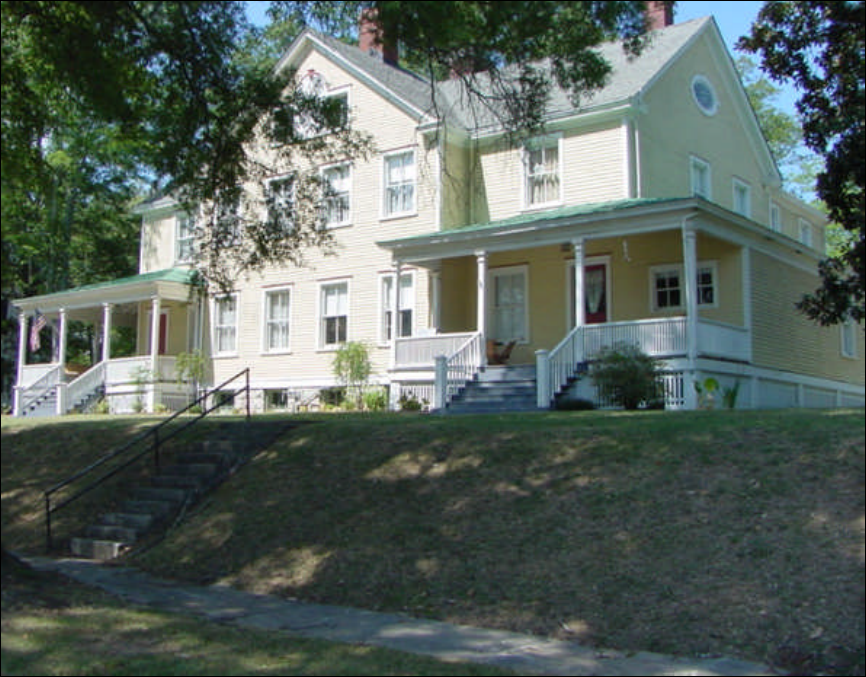
46
Barnhardt Circle Home – Historic District
Light Industrial Area
Commonly refers to low intensity manufacturing, wholesale trade, and distribution
activities that do not generate excessive noise, particulate matter, vibration, smoke, dust,
gas, fumes, odors, radiation, or other nuisance characteristics.
Landscaping and site design can soften or shield views of buildings and parking lots,
loading docks, etc. Signage and lighting guidelines can be used to enhance the quality
of the development.
Regional Activity Center - Hospital
Concentration of regionally marketed commercial and retail centers, office and
employment areas, higher-education facilities, sports and recreational complexes.
These areas are characterized by high degree of access by vehicular traffic, on-site
parking, low degree of internal open space, high floor-area-ratio, large tracts of land,
campus or unified development.
Development strategies should include a high-density mix of retail, office, services, and
employment to serve a regional market area. Design should be pedestrian oriented with
walkable connections between different uses. Architectural styles that maintain the

47
regional character should be encouraged rather than “franchise” or “corporate”
architecture.
Regional Activity Center – Hutcheson Medical Center
Character Areas
Stable neighborhood
Stable neighborhoods are characterized by relatively well-maintained housing, have a
distinct identity through architectural style, lot and street design, and with high rates of
homeownership. The bulk of Fort Oglethorpe’s housing can be classified as stable
neighborhood. The City’s historic role as a military installation has equipped it with
infrastructure and development patterns that are consistent with traditional neighborhood
development principles.
Contribute to stability through encouragement of additional homeownership and building
code enforcement. Vacant properties ought to be identified and targeted
for infill development. A well-designed new neighborhood activity center would provide a
focal point for the neighborhood, while also providing a suitable location for a grocery
store, hardware store, and similar appropriately-scaled retail establishments serving
neighborhood residents.

48
Stable neighborhood
Commercial redevelopment area
Characterized by declining, unattractive, vacant or under-utilized strip shopping center it
has a high degree of access by vehicular traffic and transit if applicable;
on-site parking; low degree of open space; moderate floor-area-ration; large tracts of
land, campus or unified development.
Fort Oglethorpe has identified the area north of Patterson Ave. to the east to Cross St.
and west of Hwy 27 to the city limits as being a commercial redevelopment area.
Development strategies may involve retrofitting to be more aesthetically appealing and
marketable to tenants. One example is to build new commercial structures at the street,
taking up part of the oversized parking lot and creating a shopping “square” around a
smaller internal parking lot. Older commercial buildings can be updated with façade
improvements, new architectural elements,
or awnings. Parking lots and circulation routes can be reconfigured for automobiles.
Pedestrian and bicycling amenities such as covered walkways, benches, lighting and
bike racks may lure tenants and customers. Landscaping, shade trees in parking lots
enhance the comfort level and help reduce stormwater runoff as well.

49
Commercial Redevelopment Area
Employment center
Typically campus-style development characterized by high degree of access by
vehicular traffic, on-site parking; low degree of open space and moderate floor-area-
ratio.
Suggested development strategies involve encouragement of pervious paving and
screening of cars and other unattractive aspects of businesses, perhaps buffered to
separate from adjacent uses. A greater mix of uses (such as retail and services for
employees) will reduce automobile reliance and use on site.
Industrial
Land used in higher intensity manufacturing, assembly, processing activities where
noise, particulate matter, vibration, smoke, dust, gas, fumes, odors, radiation, or other
nuisance characteristics are not contained on-site.
A suggested development strategy may include encouraging a greater mix of uses
(such as retail and services to serve industry employees) to reduce automobile reliance/
use on site.
50
Industrial Area
Linear greenspace
Areas of protected open space that follow natural and man-made linear features for
recreation, transportation and conservation purposes and links ecological, cultural and
recreational amenities. The creekwalk represents an area of linear greenspace. Linear
greenspace can be created by linking of pedestrian and bicycle connections between
schools, churches, recreation areas, city centers, residential neighborhoods and
commercial areas.
Neighborhood redevelopment
A neighborhood where housing conditions are worsening perhaps due to low rates of
homeownership and neglect of property maintenance. It may be lacking in identity and
gradually may become invaded by different types and intensity of uses that may be
incompatible with the neighborhood residential use.
Suggested development strategies involve encouraging a greater degree of owner-
occupied housing through public assistance and investment, and targeting of infill
opportunities of new, architecturally compatible housing to vacant properties in the
neighborhood.
The City has designated areas north of the major highway corridor along Hwy 2,
immediately south of Patterson Ave. as a neighborhood redevelopment area.
51
Other/special
Used to delineate a district or area that presently does not fit or is not envisioned fitting
into the above categories. It may have singular characteristics such as a hospital,
airport, big box, etc. that makes it unique within the community.
Stable neighborhood (see above)
Suburban area
The suburban area of the City consists of new housing development that has recently
been annexed at the outskirts of the core of the City.
Typical types of residential subdivision development have occurred here. Suggested
development strategies include: retrofitting to better conform with traditional
neighborhood development, i.e. creating neighborhood focal points by locating schools,
community centers, or well-designed small commercial activity centers within walking
distance of the

52
Fort Oglethorpe Areas Requiring Special Attention

53
Fort Oglethorpe ISSUES AND OPPORTUNITIES City
Population Change (Y/N)
Rapid population growth is expected in the next 20 years. Y
The ethnic diversity of the community will increase and these changes will
require adapting schools and public services to a wider array of language and
cultural patterns.
Y
The proportion of the population that is over 65 years of age will increase and
this population group will require specialized housing and services. ALREADY
REQUIRE SPECIALIZED HOUSING & SERVICES
Y
Educational attainment for the community is lagging behind that of the rest of the
county, region, and the state.
N
Household income levels for the community are lagging behind that of the rest of
the county and will increase the demand for services related to poverty.
N
Economic Development
Existing Businesses
Our community’s dependency on a small number of industries/business types
results in high vulnerability to downturns in the dominate industry type.
N
Economic development programs do not support existing businesses
(entrepreneur and small business assistance, business retention programs, etc.).
NOT PROGRAM IN PLACE
Y
Our community does not track the existing businesses in our community for
changing levels of support and assistance needed.
Y
Our community does not have an active business recruitment and retention
program.
Y
Existing businesses in our community have not been growing or expanding. N
Existing businesses in our community do not participate in
events/programs/issues.
N
Local businesses are not satisfied with assistance from local economic
development organizations. NO ORGANIZATION
Y
The local economy does not compare well to peer communities. N
Prospective Businesses
Business recruitment efforts do not match levels of local/regional workforce
education and training.
N
Business recruitment efforts do not focus on business types compatible with
existing businesses.
N
Recruitment efforts do not focus on growth industries: businesses that have good
survival rates and contribute to quality of life.
Y
Tools/Methods
We do not have a community vision for economic development activities in the
form of an economic development strategic plan; or the plan was not developed
with meaningful stakeholder input.
Y
We do not have a long-term infrastructure plan that guides, directs and supports
development.
Y
Our community needs a variety of effective economic development
agencies/authorities.
Y
There is a lack of communication between
government/agencies/authorities/private sector entities involved in economic
development.
Y
Community efforts at recruiting targeted industries are unsuccessful. Y
There are limited economic development resources to market the community N

54
Our community economic development programs:
No
programs
- do not use innovative tools Y
- do not use multiple methods and funding sources to support and attract
businesses
Y
- do not use appropriate business recruitment, i.e. niche marketing, downtown
revitalization
Y
- do not use regional identity and tourism as a marketing and development tool Y
- do not use unique and potentially negative situations as new opportunities Y
- do not provide a range of job types that meet needs of local workforce Y
- do not reflect changing economy: technology, tourism, service Y
- do not identify, acquire, assemble and/or stabilize property for redevelopment Y
- do not focus both on revitalization of existing commercial structures and
creation of future neighborhood commercial districts
Y
- do not use a comprehensive redevelopment strategy to accommodate new
development while enhancing existing local assets
Y
- do not use incentives to encourage targeted types of businesses Y
- do not analyze the types of enterprises that would fit effectively into the local
economy, including those that could be accommodated immediately
Y
- do not include industrial development, town center development, chamber-
based promotion and tourism development
Y
- do not identify job opportunities for particular community populations Y
- do not publicize economic development successes Y
Economic Development & Land Use Interaction
Our community is experiencing uncontrolled growth and poor land use planning. Y
Pristine land/greenfields are being developed. DOING AWAY WITH GREEN
AREAS
Y
Our community has not analyzed the cost of infrastructure, services, incentives
versus benefits of economic development projects.
Y
There are constraints to business formation imposed by inadequate capital
availability or usage.
?
There is a lack of physical convenience and accessibility of jobs to workforce. N
Our community has inadequate public facility capacity to attract new
development where development is desired. Also a lack of publicly-owned land.
Y
There is an imbalance between location of available housing and major
employment centers. MAJOR EMPLOYERS ARE SCHOOL BOARD AND
HUTCHISON MEDICAL CENTER
N
Our community has a proliferation of abandoned buildings and vacant land.
SOME
N
There is disinvestment in key areas. Y
Redevelopment process is perceived as difficult. N
Local lenders perceive risks in redevelopment. N
Potential redevelopment properties have unknown or suspect historical uses and
potential contaminants causing risks and uncertainties for new or existing
property owners.
Y
There are perceived additional and high costs for site assessment, underwriting,
site development, rate of return, cleanup plan and cleanup.
Y
Infrastructure investments are needed to remain competitive in business
recruitment and community resources are inadequate.
Y
Workforce

55
Our community does not offer enough jobs or economic opportunity to retain
local residents.
Y
The workforce capabilities, supply, quality, and training needs are unknown. Y
There is an imbalance of available jobs and available education and training of
citizens/workforce.
N
Educational and workforce training opportunities are not readily available. N
Accessible and low-cost services to transport workers directly to job sites are not
available.
Y
There is not enough affordable/workforce housing. N
There are no priorities for recruitment, expansion and training. Y
There is a mismatch between available workforce and available or preferred job
recruitment strategies.
Y
There is a mismatch of labor skills and business needs. Y
Natural & Cultural Resources
Resource Awareness
The community’s resources worthy of protection have not been identified—there
is no inventory of resources.
Y
Community resources have not been mapped or compared to areas of future
development.
Y
Management planning for significant community resources is needed. Y
There is no on-going and active education about resource conservation and
protection for the public, local elected officials, developers, economic developers,
etc.
Just started.
Development entities are not aware of community resources. Y
The public does not have adequate access to community resources. PROBLEM
IS COMMUNITY AWARENESS
N
The community is not working regionally to protect resources. Y
Community resource conditions are endangered and/or declining. Y
Development is diminishing environmental quality of community resources.
(DIVIDED THIS INTO TWO QUESITONS)
Y
Development is diminishing historic integrity and/or cultural significance of
community resources. (DIVIDED THIS INTO TWO QUESTIONS)
N
New development is occurring in inappropriate areas: farmlands, environmentally
sensitive areas. (DIVIDED THIS INTO TWO QUESTIONS)
Y
New development is occurring in inappropriate areas: historic neighborhoods.
(DIVIDED THIS INTO TWO QUESTIONS)
N
The rural scenery in and around our community is disappearing. Y
There are not enough parks or greenspace. Y
The community has abandoned or contaminated properties. Y
There are pollution problems (light, noise, water, air, etc.).
Y
There are erosion, sedimentation, storm water runoff problems. Y
Land values are increasing but taxes are not increasing. N
Implementation/Enforcement
The protection of community resources is inadequate. (AVERAGE) Y
Our community has not developed means of protecting significant resources.
(DIVIDED THIS INTO TWO QUESTIONS) Water & Sewer ordinances lacks
teeth. Need to beef it up a bit. Working on it.
Y
Existing ordinances lack enforcement. (DIVIDED THIS INTO TWO QUESTIONS) N
Our community’s resources do not play significant role in decision-making. Y
Our community’s resources are not being improved, enhanced, and/or promoted. Y

56
Our community’s policies and regulations do not allow for protection of
community resources.
N
The design of the community does not help conserve resources and minimize
waste. NO DESIGN
Y
New development is not being guided away from resources—directly or
indirectly.
Y
Resource protection regulations are not enforced or enforcement is inadequate.
AVERAGE
IMPROVING
Our community is not in compliance with Part V. COULD IMPROVED Y
There are not regulations against unwanted/environmentally hazardous uses
(hog farms, landfills, etc)
N
Environmentally sensitive areas of the community, such as stream banks,
floodplains, or steep hillsides, are not set aside from development.
Y
Best management practices are not encouraged or required as part of the
development process.
N
There are not appropriate site design guidelines in place for developing on
sensitive areas (e.g. steep slopes, wetlands).
Y
There are no linkages (existing or planned) between local trail systems, state
designated bike routes, and existing trails in neighboring communities.
Y
Our community does not have programs that encourage infill development or
brownfield/greyfield redevelopment.
Y
Facilities and Services
Fiscal
The relative costs of community services have not been considered or compared
to different development types (open space/farmland; industrial/commercial;
residential).
Y
The future costs of providing services at current growth rates and for the same
types of development patterns have not been considered.
Y
The costs of providing community services for new development are not known
or considered.
Y
Our community does not have the fiscal capacity to meet future needs. Y
Our community’s policies and regulations do not foster development that
optimizes long-term governmental fiscal health.
Y
Existing infrastructure investments (i.e. already paid for) are not being protected
by encouraging infill, redevelopment, and compact development.
Y
Physical
Our community has not defined areas of service and areas of no service. N
Our community does not place infrastructure to direct growth and development to
identified areas and away from sensitive areas.
Y
There is not equitable access to public facilities for all income levels. N
Our community is not physically locating services (infrastructure, buildings) in
compact areas to benefit the citizenry and make for easy access (walking, car,
bike, etc.).
N
The age, capacity function, safety, and maintenance needs of community’s
public facilities have not been inventoried.
N
There is no long-term strategy for the location or maintenance of public service
facilities.
N
The efficiency of the community’s services needs improvement. Y
Housing
Housing Mix & Future Demand
There is no mix of housing types in neighborhoods/new developments in our N

57
community.
Our community does not have varied housing options available to meet
residents’ needs at all stages of life.
N
Our community’s neighborhoods do not have a healthy mix of uses, like corner
groceries, barber shops, or drugstores within easy walking distance of
residences.
Y
Schools are not located within our community’s neighborhoods. SOME ARE
AND SOME ARE NOT
--
There is a lack of special needs housing (elderly, handicapped, etc.) in our
community.
N
There is no inventory of public and private land available for the development of
future housing.
Y
Existing structures suitable for conversion to affordable or subsidized housing
are not being redeveloped.
Y
Workforce/Affordable Housing
There is a lack of affordable or subsidized housing in the community relative to
income and wages.
N
The incentives and barriers to maintenance and/or development of
affordable/workforce housing in the community have not been inventoried.
Y
There is an imbalance between location of available housing and major
employment centers in the community.
Y
The community has not compared housing costs and income levels to the
available housing stock.
Y
Housing & Land Use Interaction
Our community’s housing needs and the land use plan do not relate. Y
Our community does not have an inventory of vacant properties, properties
owned by the city or other government agencies, and tax delinquent properties
suitable for infill development.
Y
Our community does not have adequate housing ordinances and regulations. N
The community does not regulate to better protect stable residential areas. N
Residential uses are not allowed in the central business district. Y
Local ordinances and regulations do not provide at least one or more areas that
allow mixes of residential and commercial uses.
N
Our community does not require or encourage new developments to reserve a
percentage of proposed units for affordable housing.
Y
Our community does not take measures to encourage well-designed infill and
medium to high density multi-family residential development in appropriate
locations.
Y
Code enforcement is not adequate to prevent substandard housing and
maintenance.
Y
Housing Programs
Our community does not have a housing authority. N
Our community does not have any community-based organizations that provide
housing (i.e., community development corporations, Habitat for Humanity, land
bank authority).
Y
Our community lacks:
o maintenance, enhancement or rehabilitation programs. Y
o incentives programs for affordable infill housing. Y
o readily available home buyer education program. N
Land Use

58
The current conditions of our community do not relate to goals and objectives of
our previous comprehensive plan.
Y
Development Patterns
The design of our community does not promote conservation of resources and
minimization of waste.
Y
There is no clear boundary where town stops and countryside begins. Y
Our community’s development patterns discourage interaction with neighbors. N
Our community’s development patterns do not create safe, walkable and
pedestrian-friendly environments. DO NOT CONNECT
N
Public spaces are not designed to encourage the attention and presence of
people at all hours of the day and night.
Y
Our community does not have a center focus that combines commercial, civic,
cultural and recreational uses.
Y
Housing and commercial buildings in rural areas are not concentrated in small,
well-planned nodes (i.e. villages with lots of intervening farmland or open space).
Y
Our community is not relatively compact (i.e., typical Georgia lot size is 1/4 acre),
but spread out and only accessible by car.
Y
Our community does not have design guidelines to ensure appropriate new and
infill development that complements the character of the community. (Lyerly
does not allow trailer parks to be built.)
Y
Development Process
Community stakeholders are not involved in the community planning and
development review process.
Y
Our community’s land use/development regulations and Future Land Use map
do not match.
Y
Our community’s Land Use map does not look reasonable in terms of allocating
future land uses.
Y
Our community does not have land development regulations or does not enforce
its regulations.
N
There are obvious inconsistencies in our community’s development regulations. Y
The development regulations for the community are not illustrated where
appropriate.
Y
We do not have a checklist for development review. N
There are subjective aspects to development regulations that leave too much
discretion in the hands of staff.
Y
There is not qualified staff to conduct development reviews in our community. N
Our community’s development regulations do not incorporate best practices as a
component (storm water management, site development, landscaping, etc).
N
Our community’s land use and development regulations do not foster mixed use
development, infill development, neighborhood commercial, planned unit
development, or cluster development, or consider continuous streetscapes and
pedestrian atmosphere.
Y
The permitting process is unnecessarily duplicative, excessive and unfair. N
Our community has not adopted/does not enforce building codes. N
Small Cities rely on the County for enforcement of building codes. N
Our community has not adopted a rehabilitation code. N
Code enforcement is not conducted in a fair and consistent manner. N
There are no screening requirements between incompatible land uses. Y
There is no expedited plan approval process for quality growth projects. Y
There is no site plan review required as a back up for building regulations.
N

59
Transportation
Current & Future Conditions
The current conditions of our community do not relate to goals and objectives of
our previous comprehensive plan.
Y
Our community does not offer equitable access to mobility. N
Our community’s current transportation systems contribute to air and water
pollution. ACCORDING TO EPA
Y
Current transportation systems waste gas and energy. Y
Our community’s current transportation systems eat up open space, farmland
and wildlife habitat.
N
Current transportation systems are shifting business away from downtown or
other town centers.
Y
Our community’s current transportation systems limit people’s choices. Y
Our community does not have an effective public transportation system. Y
The community does not offer clean public transportation, such as fuel-efficient
transit buses.
Y
Transportation does not seem to be coordinated with the way the community is
growing.
Y
Our community’s current transportation systems do not create redundancy,
resiliency and connectivity within road networks.
Y
There is little connectivity between pedestrian, bike, transit, and road facilities. Y
The community’s roadway designs are not sensitive to roadway uses or local
concerns.
Y
In our community, there is a spatial mismatch between adequate transportation
services and transit dependent populations’ access to jobs, services, goods,
health care and recreation.
Y
The regional land use planning structure is not integrated within a larger
transportation network built around transit, but instead one built around freeways.
Y
We do not have a comprehensive transportation study that includes parking,
traffic and transit, both local and regional.
Y
We have a high accident rate, increasing congestion and gridlock. Y
Citizens are experiencing increasing commute times and distances--more people
driving longer distances in traffic to reach home, school, shopping, or work.
Y
Taxpayers are frustrated as more and more money is spent to expand roadways
while traffic congestion remains unchanged.
Y
New and expanded roads in the community cause an increase in driving and
congestion.
Y
New and expanded roads in undeveloped areas soon attract new housing,
shopping, and business centers.
Y
Streets in our community are not designed according to their use in order to
assure appropriate travel speeds.
Y
There is little or no flexibility to adjust the design or operation of roadways in
case of future changed conditions.
Y
Inter-parcel connections between individual developments, where compatible,
are not encouraged or mandated in the community.
Y
Our community has many streets where traffic travels at inappropriate speeds,
making pedestrian activity unsafe and unappealing.
Y
Our community right-of-way pavement standards do not allow for flexible street
widths to accommodate different usage patterns or to promote walkability.
N
Our community’s major corridors suffer from congestion, clutter, signage and Y

60
sprawl.
Alternatives/Amenities
Our community has few alternatives to using a car to get to places and to
eliminate traffic congestion.
Y
There is an imbalance between auto-dependent transportation projects and
alternative transportation projects.
Y
The community is not pedestrian or bike friendly. Y
Community streets, pedestrian paths and bike paths do not contribute to a
system of fully-connected and interesting routes to all destinations.
Y
Community streets, pedestrian paths and bike paths do not encourage
pedestrian and bicycle use because they are not spatially defined by buildings,
trees and lighting; and do not discourage high speed traffic.
Y
The community does not have enough sidewalks and bike trails and those that
exist are not well-linked.
Y
Pedestrian amenities and safety features are not required or invested in.
(DIVIDED INTO TWO QUESTIONS)
Y
Community crosswalks are not effective. (DIVIDED INTO TWO QUESTIONS) N
Streetscape improvements in our community are not geared towards traffic
calming and pedestrian/bicycle friendliness.
Y
Housing, jobs, daily needs and other activities are not within easy walking
distance of one another in the community.
Y
There is a lack of activities located within easy walking distance of transit stops. Y
Transportation & Land Use Interaction
Our community’s higher intensity uses like retail shops, offices, or apartments
are not concentrated along major roadways.
N
Street layouts in new developments are not compatible with those in older parts
of our community, and do not connect to the existing street network at many
points.
Y
Parking
We do not have enough on-street parking allowed in places where it can be
safely provided, such as in downtown areas and pedestrian-retail districts.
Y
The community does not offer a variety of potential parking solutions, including
alternate, attended, shared, paid parking locations; such as industrial areas (off
hrs. and weekends), church and school lots, etc. or alternative parking
arrangements for commercial development as well as parking programs for in-
town neighborhoods (i.e., decals for residents, passes for resident guests).
Y
There is a lack of available parking in busy activity centers. N
Intergovernmental Coordination
There is inadequate and ineffective regional or multi-jurisdictional cooperation.
AVERAGE
N
There is little or no coordination with other local governments in order to manage
economic opportunities.
Y
Our community does not coordinate with other local governments in order to
maintain local control of growth and development.
Y
There is little or no coordination with other local governments in order to protect
environmentally sensitive areas, historic and cultural resources.
Y
Our community does not coordinate with other local governments in order to
ensure maintenance of roads; delivery of utility services; efficient investment in
schools and other public buildings.
N
There is no process in place to ensure consistency with the land use regulations
of contiguous governments.
Y

61
Our community does not participate in multi-jurisdictional sharing and integration
of plans, causing conflicts and adversarial conditions.
Y
Our community does not have any border agreements to address detailed
questions of land use, access, property value and annexation procedures.
Y
There are inadequate efforts to increase cooperation and build trust between the
city and county governments.
Y
There are inadequate efforts or programs to continue and strengthen liaisons
that foster communication and coordination among residents, the business
community and other entities.
Y
There are inadequate local government efforts to provide efficient, available,
responsive, and cost-conscious programs to meet the needs of citizens.
N
There are inadequate efforts or programs to ensure that implementation of
growth policy, development impacts and mitigation are addressed.
Y
There are inadequate efforts or programs to continue advocating public
participation in growth policy formation and revision process.
Y
There are inadequate efforts or programs to build and strengthen relations with
technical colleges/universities in the community and region.
Y
The government is not adequately represented at local and regional group
meetings.
N
Non-profit and neighborhood organizations, etc. are not adequately represented
at government meetings.
N
We decided in our discussion that we do not like the word inadequate in these questions. We like
average better. Here are some of our items to be added to our list of areas requiring special
attention. I am sure that through the remainder of the process we will have more:
Try to move away from typical strip shopping centers.
LaFayette Road (Old part of Hwy 27) Downtown Revitalization and incorporate maybe a
Downtown Development Overlay District with special design guidelines to enhance the
Battlefield Park.
Water & Sewer ordinance amendments to beef of environmental regulations such as requiring
oil and grease traps with specific design standards.
Amend sidewalk ordinances to include requirements for commercial developments and to add
connectivity requirements.
Develop specific design guidelines for stormwater infrastructure such as catch basin etc.
More attention paid to preservation of natural and cultural resources.

62
City of Fort Oglethorpe
SUMMARY OF SHORT TERM WORK PROGRAMS
Economic Development 2008 2009 2010 2011 2012
Responsible
Party
Cost
Estimate
Funding
Source
*Pursue grants funds for Better Hometown
Program and grants for tourism development ’07 X City TBD Local

63
City of Fort Oglethorpe
SHORT TERM WORK PROGRAMS
Community Facilities/Services 2008 2009 2010 2011 2012
Responsible
Party
Cost
Estimate
Funding
Source
Streets and Recreation Department
*Build new swimming pool (refurbish) X City 800,000 Local
*Build new ballfield complex X X X X X City, County 5,000,000
Local,
DNR
Build new bathhouse and concessions X X City 500,000 Local
Develop recreation gymnasium and senior center X City, County 500,000 Local
Build new garage or relocate to wastewater plant X City 800,000 Local
New maintenance building at recreation park X City 60,000 Local
Community Facilities and Services
Fire and Police Department
*Replace fire truck and upgrade pump ’07 X City 205,000 Local
*Shore Jacks X City 9,000 Local
*10 sets of new turnout gear
X City 60,000 Local
*2 new chief cars X City 40,000 Local
*Recovery bags X City 10,000 Local
*items asterisked indicate carryover from previous STWP

64
City of Fort Oglethorpe
SUMMARY OF SHORT TERM WORK PROGRAMS
2008 2009 2010 2011 2012
Responsible
Party
Cost
Estimate
Funding
Source
Community Facilities and Services
Fire and Police Department (cont.)
*Add three additional firefighters move to 24 hr. on 48
hr. off shifts for fire suppression personnel to cover all
shifts (this depends on outcome of FLSA. If it reduces
to 48 hrs. then we will stay 40 hrs. per week X City 93,495 Local
6 new breathing apparatus X City 36,000 Local
2 additional firefighters X City 98,000 Local
5 new pagers X City 1,900 Local
Increase fire department training budget X City 25,000 Local
Travel/Meal/Lodging for training X City 2,700 Local
4 new portable radios for apparatus to improve and add
on to 800 system
X City 16,000 Local
Replacement of Chief vehicle (rotation) of older vehicle X City 32,000 Local
Replace Wagon 1 1972 Mack (due to 6mos to 1 yr
delivery, order late ’08, delivery ’09, first pmt ‘10 X City 330,000 Local
Property and building for new fire station in Hwy 2 E
area X City 900,000
Local,
USDA,
GEFA
Open new station (if centralized, move paid/volunteer
crew X City 300,000 Local

65
City of Fort Oglethorpe SUMMARY OF SHORT TERM WORK PROGRAMS
Community Facilities and Services
Fire and Police Department (cont.)
2008 2009 2010 2011 2012
Responsible
Party
Cost
Estimate
Funding
Source
10 sets of new turnout gear X City 60,000 Local
6 new breathing apparatus X City 36,000 Local
3 additional firefighters X City 147,000 Local
5 new pagers X City 1,900 Local
2 Thermal Imaging Cameras X City 25,000 Local
Training center (Combination fire/police) X
City (area
govt’s) 900,000
Local,
USDA,
GEFA
8 new portable radios to improve/add to 800 system X City 32,000 Local
Replacement of Chief Vehicle (rotation of older vehicle) X City 32,000 Local
Replace Truck 1 1970 tractor drawn aerial ladder (due to
6 mos to 1 year delivery 2010, first payment 2011 X City 360,000 Local
10 sets of new turnout gear X City 60,000 Local
6 new breathing apparatus X City 36,000 Local
3 additional firefighters X City 155,000 Local
5 new pagers X City 2,000 Local
1 Thermal Imaging Camera X City 12,500 Local

66
City of Fort Oglethorpe
SUMMARY OF SHORT TERM WORK PROGRAMS
Community Facilities and Services
Fire and Police Department (cont.) 2008 2009 2010 2011 2012
Responsible
Party
Cost
Estimate
Funding
Source
8 new portable radios to improve and add on to 800
system X City 32,000 Local
Replacement of Chief Vehicle (rotation of older vehicle) X City 32,000 Local
Replace Hose 1 1983 Pirsch (due to 6 mos to 1 yr
delivery 2011, first payment 2012 X City 390,000 Local
10 sets of new turnout gear X City 60,000 Local
6 new breathing apparatus X City 36,000 Local
3 additional firefighters X City 162,750 Local
5 new pagers X City 2,000 Local
Replace Ladder 1 (1997 Smeal which is owned by
County) X City 820,000 Local
4 new portable radios to improve and add on to 800
system X City 16,000 Local
Replace Spartan Engine 1 (due to 6 mos to 1 yr
delivery 2012, first payment 2013) X City 400,000 Local
10 sets of new turnout gear X City 60,000 Local
6 new breathing apparatus X City 36,000 Local

67
City of Fort Oglethorpe
SUMMARY OF SHORT TERM WORK PROGRAMS
Community Facilities and Services
Fire and Police Department (cont.) 2008 2009 2010 2011 2012
Responsible
Party
Cost
Estimate
Funding
Source
3 additional firefighters X City 170,900 Local
5 new pagers X City 2,000 Local
1 Thermal Imaging Camera X City 12,500 Local
4 new portable radios to improve and add on to 800
system X City 16,000 Local
Community Facilities and Services
Water and Wastewater Department
*Update water and sewer ordinances X City 50,000 Local
*Replace water mains in areas outlined in five year
water and sewer Capital Improvements Plan (CIP)
(undersized lines, under structures, etc.) ’07 X City 675,000 Local
*Upgrade all sewer lift station with radio telemetry and
central computer control ’07 X City 100,000
Local,
GEFA,DCA
Continue work on West Chickamauga Interceptor
Sewer ‘07 X City 446,000
Local,
GEFA,DCA
Continue repairs to the existing sanitary sewer system ’07 X City
Begin upgrade to water meters to radio read ’07 X City
Build pole barn at city yard ’07 X City
Abandon Mitchell Acre oxidation pond X City

68
City of Fort Oglethorpe
SUMMARY OF SHORT TERM WORK PROGRAMS
Community Facilities and Services
Water and Wastewater Department (cont.) 2008 2009 2010 2011 2012
Responsible
Party
Cost
Estimate
Funding
Source
Purchase new backhoe X City
Additional connection points to Tennessee American
Water Co. X City
Expand sewer collection system to Lakeview Area of
Catoosa County X City
Investigate feasibility of independent water supply X City 30,000 Local
Water main project to “loop” water system X City
Upgrade existing water mains X City
Community Facilities and Services
Stormwater Department
Construct additional storm water drainage & rehab
existing storm water drainage system ’07 X X X City 2 million
Local,
GEFA,
DCA

69
City of Fort Oglethorpe
SUMMARY OF SHORT TERM WORK PROGRAMS
Land Use
Code Enforcement and Inspection 2008 2009 2010 2011 2012
Responsible
Party
Cost
Estimate
Funding
Source
2 new pick-up trucks X City 50,000 City
2 additional inspectors X City City
Additional software for GIS X City City
Extend city limits X City 0 City
Adopt masonry ordinance for new construction X City 0 City
Make improvements to Stormwater Ordinance X City 0 City
*Revise zoning ordinance (Amend current Zoning Ordinance
to comply with Zoning Procedures Act and promote
annexation plan for city) X City 0 City
*Amend land subdivision regulations X City 0 City
*Nature park (Hariler & Gracie) X City 30,000
Local,
DNR
grant
*Multi use trail (Gilbert Stephenson Park to nature park) X City 150,000
Local,
DNR
grant
*Training for codes enforcement personnel X City 5,000 Local
*Update and amend land use element of comprehensive
plan X City 5,000 City

70
City of Fort Oglethorpe
SUMMARY OF SHORT TERM WORK PROGRAMS
Land Use
Code Enforcement and Inspection 2008 2009 2010 2011 2012
Responsible
Party
Cost
Estimate
Funding
Source
*Adopt Greenspace Plan X City 200 Local
*Implement Greenspace Plan (partial implementation
through 2005)* Ft. Oglethorpe is part of Catoosa Co.
greenspace plan; as such receives 17% of available funds;
program funding is projected thru 2005 X X X X X City 144,000
Local,
DNR
NATURAL AND CULTURAL RESOURCES
*Develop a citywide GIS database of all identified cultural
resources, including National Register listed and locally
designated historic properties and districts. Incorporate the
use of the citywide GIS database of cultural resources into all
city planning. X City
*Nominate other historic properties and districts to the
National Register as they become eligible. X X X X X City
Revisit local historic preservation ordinance, its purpose,
wording, and changes to the Historic Preservation
Commission X
Historic
Preservation
Commission TBD TBD
Create a boundary to the Historic District in accordance with
state and national standards Explore the use of historic
overlays to assure the preservation of the historic nature of
the District X
Historic
Preservation
Commission TBD TBD
Improve the identity of the Historic District through various
means: signage, murals, building wall coverage, etc. X X
Historic
Preservation
Commission TBD TBD
Develop educational materials explaining historic
preservation, historic districts National Register guidelines,
design guidelines, benefits and responsibilities of the
concerned parties – to homeowners, elected officials, other
agencies, commissions and groups and to the community at
large X X
Historic
Preservation
Commission TBD TBD

71
Develop and maintain a Historic Preservation
Commission website as an outreach tool to the
community
Develop tool to make potential owners aware of a
National Registration of Historic Places designation
of a particular property
*Implement/Enforce Environmental Ordinances X City
HOUSING
*Joint comprehensive housing study which will look at
affordability, demand by age groups, quality of construction
and whether building codes are insuring quality construction,
(especially in multi-unit dwellings) X
County,
Fort
Oglethorpe,
Ringgold 4,000
LDF
grant

72
Fort Oglethorpe 2001-2005 REPORT OF ACCOMPLISHMENTS
** (Currently underway or
temporarily postponed
programs should appear in
the new STWP)
Work Program
Completed
**
Currently
Underway
** Postponed
*
Not
Accomplished
*
* Explanation for
Postponed or
Unaccomplished
Program
COMMUNITY FACILITIES
Activity
New air truck to fill bottles at fire scene
X
Hire 5 full time firefighters weekdays 8am to
4:30pm
2007 5 in
house
Construction of fire training center
X
Looking at as a
regional project
1989 LTI 110 Tractor Drawn Aerial Ladder
X
Funding
New sets of Jaws
X Funding
Replace and upgrade fire turnout gear ( 10
sets/yr) X Funding
Increase fire dept. training budget to 120 hrs/yr
X
Funding
Replace fire truck and upgrade pump
X
Replace ladder one on fire truck
X Funding
Property and building for new fire station on
Hwy 2 East X
Cost prohibitive,
property issues
Shore Jacks
X
Upgrade Cairns Iris Unit infra red
X
Not upgradeable

73
Work Program
Completed
**
Currently
Underway
** Postponed
*
Not
Accomplished
*
* Explanation for
Postponed or
Unaccomplished
Program
Fire Flir
X 4 from County funding
Purchased land for new Station 2
X
Open new Station 2 (could move Station 8
personnel and equipment if County stops
funding) X
10 sets of Turnout Gear
X
Using repair service
rather than purchase
new to cut cost
3 new Breathing Apparatus Fire Dept
X
No new hires to outfit
2 new chief cars
X
1 Truck or car
1 command truck
Recovery bags
X
3 were donated in ’06,
awaiting more
Add three additional firefighters
X
Replace wagon 1 -1972 Mack Engine I will be
paid off May, 2005. Go out to bid during Sept.,
2004 for an Engine because it takes 6 months
to a year for delivery. Delivery should be in
2005 and the first payment would not come
due until 2006 X
Funding: County and
city
Add three additional firefighters move to 24 hr.
on 48 hr. off shifts for fire suppression
personnel to cover all shifts (this depends on
outcome of FLSA. If it reduces to 48 hrs. then
we will stay 40 hrs. per week X
Funding via city,
County’
Hire 2 police officers
X

74
Purchase two new police department patrol
cars X
Work Program
Completed
**
Currently
Underway
** Postponed
*
Not
Accomplished
*
* Explanation for
Postponed or
Unaccomplished
Program
Purchase five new police department patrol
cars X
Hire one police dispatcher
X
Not needed. Calls are
now sent to 911
Increase starting salaries for Police Officers
X
Increase starting salaries for Police Officers
X
Increase starting salaries for Police Officers
X
Increase all Police salaries
X
Place mobile computers in patrol cars
X
Place mobile computers in patrol cars
X
Replace GCIC computer system
X
GCIC system going to
be web-based
Hire records clerk for police department
X
New air compressor
X
10 sets Turnout Gear
X 5 purchased
3 new breathing apparatus Fire Dept for 3 new
firefighters, below X
5 new pagers
X
3 purchased
Add three additional firefighters
X Funding

75
Water system improvements east side of the
City X
Work Program
Completed
**
Currently
Underway
** Postponed
*
Not
Accomplished
*
* Explanation for
Postponed or
Unaccomplished
Program
Build new ballfields
X
Refurbish swimming pool
X
New playground at rear track
X
Abandoned due to
park being too full and
there being no room
for parking
Replace 1995 Rescue One
X
Develop recreation facility Gymnasium &
Seniors Center X
Funding
GIS Plotting System
X
Construct additional storm water drainage &
rehab existing storm water drainage system X
Update water & sewer ordinances
X X
Develop storm water management ordinance
X
Establish schedule of fees (user fees) for code
enforcement office X
Computer program for building codes,
licensing, permitting, and inspections X
Upgrade Battlefield Parkway pump station
X
New interceptor will
make this pump
station obsolete
Rehab & sewer system in older section of city
(Polk, Lee, Morgan, Pegrim Circle and Forrest
Road) X

76
Build new garage (originally `build new or
relocate to abandoned WW plant) X Funding
Work Program
Completed
**
Currently
Underway
** Postponed
*
Not
Accomplished
*
* Explanation for
Postponed or
Unaccomplished
Program
Upgrade & purchase heavy equipment and
truck (second jet truck, utility truck & brush
truck) X
Replace Gracie Ave. Sewer (east of creek)
X
Replace water mains in areas outlined in five
year water and sewer CIP (undersized lines,
under structures, etc.) X
Look for independent city water source
X Funding
Build Interceptor sewer north of Hwy 2
(Patterson Ave, Edgewood & Pinewood Circle) X
Build sewer collection system Dietz Rd.
Project X
Upgrade all sewer lift station with radio
telemetry and central computer control X
Special rescue equipment (water, low angle,
funnel and cave) and two flat bottom boats
with equipment X
ECONOMIC DEVELOPMENT
Activity
Build water tank on east side of the city to
enhance fire protection & support business
growth
X
Not needed, water
connection to
T.A.W.C. replace the
need for tank
Work with Economic Development Authority to
update Local Development Surveys X

77
Support community development efforts and
create Better Home Town committee X
Work Program
Completed
**
Currently
Underway
** Postponed
*
Not
Accomplished
*
* Explanation for
Postponed or
Unaccomplished
Program
Pursue grants funds for Better HomeTown
Program and grants for tourism development X
HOUSING
Joint comprehensive housing study which will
look at affordability, demand by age groups,
quality of construction and whether building
codes are insuring quality construction,
especially in multi-unit dwellings. X
The City has
determined that they
are not interested in
development of
condominiums or
multi-family units
LAND USE
(Originally, Develop new zoning ordinance)
Amend current Zoning Ordinance to comply
with Zoning Procedures Act and promote
annexation plan for city X
Amend land subdivision regulations
X
Nature park (Hariler & Gracie)
X
Multi use trail (Gilbert Stephenson Park to
nature park X
Hire codes enforcement office assistant
(clerical part-time or full time X
Training for codes enforcement personnel
X
Update and amend land use element of
comprehensive plan X
Adopt Greenspace Plan
X

78
Work Program
Completed
**
Currently
Underway
** Postponed
*
Not
Accomplished
*
* Explanation for
Postponed or
Unaccomplished
Program
Implement Greenspace Plan (partial
implementation thru 2005) * Ft Oglethorpe is
part of Catoosa Co. greenspace plan; as such
receives 17% of available funds; program
funding is projected thru 2005. X
NATURAL, CULTURAL RESOURCES
Prepare Historic Resources Survey or
participate in county-wide survey (Conduct an
intensive-level historic resources survey of the
city.) X
Prepare Preservation Plan for the Fort
Oglethorpe Historic District X
Funding
Prepare Downtown Development Plan for US
27 corridor X
Acquire easements on significant building and
landscapes X
Develop driving tour and interpretation plan for
historic resources along Old Lafayette Road X
Update and amend historic resources element
of comprehensive plan X
Training for Historic Preservation Commission
X
UGA sponsors
historic preservation
training 2x/yr
Develop a plan for periodically updating the
cultural resource surveys. X Hasn’t been done
Develop a citywide GIS database of all
identified cultural resources, including National X

79
Register listed and locally designated historic
properties and districts. Incorporate the use of
the citywide GIS database of cultural
resources into all city planning processes.
Work Program
Completed
**
Currently
Underway
** Postponed
*
Not
Accomplished
*
* Explanation for
Postponed or
Unaccomplished
Program
Nominate other historic properties and districts
to the National Register as they become
eligible. X
Develop design guidelines for the locally
designated historic district and properties X
Develop a long-range preservation master
plan X Funding
Develop local heritage tourism programs to
promote the Fort Oglethorpe Historic District
and historic resources along Old LaFayette
Road. X
Consider directing tourism tax money into the
city s tourism commission X
City is still considering
this measure
Adopt Wetlands & Ground Water Recharge
Environmental Ordinances X
Implement/Enforce Environmental Ordinances
X
80
CITY OF RINGGOLD

81
Quality Community Objectives Analysis
Economic Development
Existing Businesses
Vulnerable to change in dominant industry
Existing business: Support/ Retention Programs
Business Participation in programs
Assistance to businesses not satisfactory
Recruitment:
Match recruitment to levels of workforce training
Sustainable, Compatible, Growth Industries
Tools
Long-term strategic plan Incl. business needs, infrastructure
Assessment of strengths, weaknesses?
Variety of economic development organizations, communication
Improve Success of efforts
o Use innovative tools
o Multiple methods, funding sources (incubator etc)
o Appropriate business recruitment (niche marketing etc)
o Change negative situations to opportunities
Land Use Interaction
Poor land use planning
Development of Pristine land/green fields
Inadequate capital and infrastructure investment
Redevelopment seen as risky
Housing centers and employment centers not balanced
Infrastructure/service cost v. benefit of economic development projects.
Risk, cost to potential buyers from environmental/ historical hazards
Workforce
Match up workforce needs with available jobs
Residents lost due to lack of opportunity
Analysis of workforce (capabilities, supply, quality, training needs)
Jobsite transportation and convenience to work
Prioritize workforce recruitment, expansion and training
Land Use
Development Patterns
No clear boundary between city, county
Public spaces are not designed for day, night access
Rural area development by node
Design guidelines for new, infill development

82
Infill Development
Small lot development (5000 SF or less) not allowed
Development Process
Educate and involve stakeholders, community
Checklist for development review
No rehabilitation code
No development guidebook
Budget for training planning commissioners
Traditional Neighborhoods
No street tree ordinance for new development
No organized tree-planting campaign
By right neo-traditional development
Housing
Housing Mix & Future Demand
No mix of housing types
Lack of special needs housing (elderly)
Redevelopment of existing structures
New development not asked to follow original design pattern
Workforce/Affordable Housing
Lack of workforce housing
No inventory of barriers to affordable/workforce housing
No comparison of housing costs/income to available stock.
Housing & Land Use Interaction
No inventory vacant, other sites for infill
Require new developments to reserve units for affordable housing.
Housing Programs
Maintenance, enhancement or rehabilitation programs.
Incentives programs for affordable infill housing.
Housing Choices
No accessory units
New residential does not follow original pattern
Encourage loft living, downtown living, or "neo-traditional’”
No small houses built on small lots (less than 5,000 square feet)

83
Facilities and Services
Fiscal
Compare service costs to taxes on land uses
Consider future costs of providing services at current growth rates, development
patterns
Costs of services for new development
Future fiscal capacity to meet future needs.
Policies and regulations to foster sustainable development for fiscal health.
Natural & Cultural Resources
Resource Awareness
No ongoing education about resource conservation for residents, developers etc.
Development diminishing environmental, historical quality
Development in rural, historical, farmland areas
Rural scenery
Pollution problems (light, noise, water, air, etc.).
Erosion, sedimentation, storm water runoff
Implementation/Enforcement
Encourage infill development or brownfield/greyfield redevelopment.
Heritage Preservation
No active historic preservation commission
Openspace Preservation
No tree preservation or tree-planting ordinance.
No greenspace plan to actively preserve greenspace
Need land use measures to protect natural resources (Part V Environmental)
Regional Identity
No agricultural economic connection to region for livelihood
Transportation
Current systems:
Systems contribute to air and water pollution.
Systems shift business away from downtown
Transaide does provide public transportation- needs to be more effective
Little connectivity between pedestrian, bike, transit, and road facilities.
Lack of comprehensive transportation study (parking, traffic, transit, local/regional)
Increasing commuting times, distances
Spending increases for expanding roadways while traffic congestion unchanged.
New, expanded roads lead to residential and commercial development
84
No flexibility to adjust roads to needs
Parking
More on-street parking
Need parking solutions (alternate, attended, shared, paid parking locations)
Lack of parking in busy centers
Alternatives/Amenities
Not enough, linked sidewalks and bike trails
Streetscapes not geared to traffic calming, Pedestrian friendliness, safety

85
City of Ringgold / Areas Requiring Special Attention
C3 Downtown Development Area
Newly designated, the C3 Downtown Development Area represents the historic district for the
city. The Planning Commission has reviewed possible historic design review guidelines and
recommended that Ringgold form a study committee for design review and institute a program
requiring a certificate of approval be obtained for building materials and design. Any expansion
of this district would require that zoning and map boundaries be changed.
Ringgold’s downtown area is bordered by Cleveland Street to the west, Mountain Street to the
North, Railroad Street to the east, and extending beyond LaFayette Street to the south. One of
several historic buildings in downtown Ringgold, the Catoosa County Courthouse anchors
Nashville Street, Ringgold’s main downtown street. The Courthouse was originally built in
1856. Illustrating the benefits of multi-function use, the courthouse was not burnt by Union
troops because it also served as the local Masonic hall. The current Colonial Revival style
building replaced the original courthouse in 1939.
Downtown also includes restaurants, commercial and small businesses, city and county
government services, the Ringgold Post Office, a famous wedding chapel, and the historic
railroad depot built in 1849 which hosts community functions. This vibrant area is highlighted for
preservation of historic aspects, design guidelines, retention and support for businesses,
recruitment of new business. To meet these needs, a downtown development authority will be
established and a local merchant’s association will supplement existing economic development
functions. (Legal description of C3 district included in Appendix A).
Historic Catoosa County Courthouse

86
Overlooking Downtown from the Historic Depot

87
Historic Train Depot
Industrial Development Area
Along SR 151 at the southern entrance to the City is the nearly Industrial Park that is almost at
capacity.

88
Commercial Development Area
The City has designated the areas immediately adjacent to the major thoroughfares, Hwy 2,
Hwy 41, and along the Interstate 75 corridor, as areas to target the location of commercial
development. Offices, businesses, commercial properties (gas stations, restaurants, retail and
chain stores), are especially targeted around the interchanges. Businesses and services extend
out from the walkable downtown area, not necessarily losing character, but becoming more
vehicle oriented with higher traffic levels, more commercial-type signage and design, etc. Hwy
41 heading to Battlefield Pkwy will most likely develop out. Plans are included in the work
program to improve community development along these corridors.
Commercial Development Area
Parks
Parks and recreation areas constitute protected greenspace in the City.
Development strategies for these areas include the widening of roadways only when absolutely
necessary, careful design of roadway alterations to minimize visual impact, and promotion of
areas as passive-use tourism and recreation destinations.
89
Water supply watershed
The lands to the east of White Mountain Ridge drain to Tiger Creek and East Chickamauga
Creek, ultimately joining to form South Chickamauga Creek, the source of water for the City of
Ringgold’s Water Treatment Plant. South Chickamauga Creek ultimately flows north to the
Tennessee River.
The Coosa Valley Regional Development Center’s report, “Northwest Georgia Water Supply
Watershed Based Regional Source Water Assessments” (January 2003) delineated an Inner
Management Zone (IMZ) in a circle 7 miles out from Ringgold’s water intake. Potential pollution
sources were identified within both that zone and an Outer Management Zone (OMZ). Public
education around non-point sources of pollution in the watershed such as septic tank seepage,
herbicides applied to roadways, power line right of ways, and lawns, sink hole and abandoned
well regulation, would go a long way toward protecting this source of the City’s drinking water.
Groundwater Recharge Areas
Recharge is the process by which groundwater is replenished. A recharge area is where
precipitation is able to transmit downward to an aquifer. Unless the area is solid rock or covered
by development or impervious areas, a certain percentage of precipitation will infiltrate. Areas
that transmit the most precipitation are referred to as “critical” recharge areas. These areas
contain characteristics that enhance the recharge potential, namely types of vegetation cover,
slope, soil composition, depth to the water table, the presence or absence of confining beds and
other factors. Symbolic of the underlying karst topography of the region, there are many
recharge areas in the city.
The Planning Commission is concerned about recharge areas to the north and south where
commercial and residential development is rapidly increasing the total impervious surfaces.
Suggested development strategies may include encouragement of the use of pervious
pavement, buffer strips, islands, etc. for parking.
Overall the community is aware of the impact of runoff on the aquifer that comprises their water
supply watershed. The City requires a greenspace set-aside of 20% for residential and
commercial development as an effort to maintain pervious surfaces.
100 year Flood Plain
Floodplains are indicated along South Chickamauga Creek.
In support of the National Flood Insurance Program (NFIP), FEMA and the State of Georgia are
currently updating Flood Insurance Rate Maps (FIRMs). FIRMs are being created to reflect the
base flood event, defined as the flood having a 1-percent chance of being equaled or exceeded
in any given year, also referred to as the 100-year flood. When this mapping is complete the
City will have access to the most recent data available. .
Wetland
The US Army Corps of Engineers defines a wetland as “…areas inundated or saturated by
surface or ground water at a frequency and duration sufficient to support, and that under normal
circumstances do support, a prevalence of vegetation typically adapted for life in saturated soil
conditions.” (Authority: U.S.C. 1344. 328.3 8B). Wetlands include swamps, bogs, ponds, and
marshes. Wetlands slow down stormwater and filters out pollutants and sediment. The City
does have an ordinance governing protection of wetlands. It has been recommended that levels
of enforcement and protection under this ordinance could be enhanced.
Severe slopes
Development on steep slopes accelerates water runoff and provokes subsequent erosion in the
watershed, leading ultimately to challenges to water quality. Development of brow areas affects

90
the viewshed. Viewsheds will be protected using such tools as conservation easements,
greenspace minimum requirements in regulations, etc. Steep slopes will be protected from
erosion with stricter enforcement of erosion and sedimentation regulations and stormwater
regulations.
Steep slopes dominate the terrain east of the City of Ringgold.
Transportation Corridors
The main thoroughfares in the City have been looked at carefully in the quest to alleviate
downtown traffic congestion.
Truck by-pass widening
Proposed truck by-pass
The City is discussing alternatives for high-speed / high weight truck travel other than adding to
the traffic congestion downtown. One possibility is to widen streets or create turn lanes, or
create an alternative by-pass where trucks can avoid the congested downtown.
Truck travel through Downtown
Proposed US 41/SR 151 Connector
The City and Planning Commission have reviewed and discussed the environmental, residential
impact, and loss of park space that the proposed 151 connector would likely cause.

91
Map of Areas Requiring Special Attention

CITY OF RINGGOLD
ISSUES AND OPPORTUNITIES
Population Change
Rapid population growth is expected in the next 20 years.
Y
The ethnic diversity of the community will increase and these changes will require adapting schools
and public services to a wider array of language and cultural patterns.
Y
The proportion of the population that is over 65 years of age will increase and this population group
will require specialized housing and services.
Y
Educational attainment for the community is lagging behind that of the rest of the county, region, and
the state.
Household income levels for the community are lagging behind that of the rest of the county and will
increase the demand for services related to poverty.
Economic Development
Existing Businesses
Our community’s dependency on a small number of industries/business types results in high
vulnerability to downturns in the dominate industry type.
Y
Economic development programs do not support existing businesses (entrepreneur and small
business assistance, business retention programs, etc.).
Y
Our community does not track the existing businesses in our community for changing levels of
support and assistance needed.
Y
Our community does not have an active business recruitment and retention program.
Y
Existing businesses in our community have not been growing or expanding.
Existing businesses in our community do not participate in events/programs/issues.
Y
Local businesses are not satisfied with assistance from local economic development organizations.
Y
The local economy does not compare well to peer communities.
Prospective Businesses
Business recruitment efforts do not match levels of local/regional workforce education and training.
Y
Business recruitment efforts do not focus on business types compatible with existing businesses.
Y
Recruitment efforts do not focus on growth industries: businesses that have good survival rates and
contribute to quality of life.
Y
Tools/Methods
We do not have a community vision for economic development activities in the form of an economic
development strategic plan; or the plan was not developed with meaningful stakeholder input.
Y
We do not have a long-term infrastructure plan that guides, directs and supports development.
Y

93
Our community needs a variety of effective economic development agencies/authorities.
Y
There is a lack of communication between government/agencies/authorities/private sector entities
involved in economic development.
Y
Community efforts at recruiting targeted industries are unsuccessful. Y
There are limited economic development resources to market the community
Y
Our community economic development programs:
- do not use innovative tools
Y
- do not use multiple methods and funding sources to support and attract businesses
Y
- do not use appropriate business recruitment, i.e. niche marketing, downtown revitalization
Y
- do not use regional identity and tourism as a marketing and development tool
Y
- do not use unique and potentially negative situations as new opportunities
Y
- do not provide a range of job types that meet needs of local workforce
- do not reflect changing economy: technology, tourism, service
- do not identify, acquire, assemble and/or stabilize property for redevelopment
- do not focus both on revitalization of existing commercial structures and creation of future
neighborhood commercial districts
- do not use a comprehensive redevelopment strategy to accommodate new development while
enhancing existing local assets
- do not use incentives to encourage targeted types of businesses
- do not analyze the types of enterprises that would fit effectively into the local economy, including
those that could be accommodated immediately
- do not include industrial development, town center development, chamber-based promotion and
tourism development
- do not identify job opportunities for particular community populations
- do not publicize economic development successes
Economic Development & Land Use Interaction
Our community is experiencing uncontrolled growth and poor land use planning.
Y
Pristine land/greenfields are being developed.
Y
Our community has not analyzed the cost of infrastructure, services, incentives versus benefits of
economic development projects.
There are constraints to business formation imposed by inadequate capital availability or usage.
Y
There is a lack of physical convenience and accessibility of jobs to workforce.
Y
Our community has inadequate public facility capacity to attract new development where
development is desired. Also a lack of publicly-owned land.
Y
There is an imbalance between location of available housing and major employment centers.
Y
Our community has a proliferation of abandoned buildings and vacant land.
There is disinvestment in key areas.

94
Redevelopment process is perceived as difficult. Y
Local lenders perceive risks in redevelopment.
Potential redevelopment properties have unknown or suspect historical uses and potential
contaminants causing risks and uncertainties for new or existing property owners.
There are perceived additional and high costs for site assessment, underwriting, site development,
rate of return, cleanup plan and cleanup.
Y
Infrastructure investments are needed to remain competitive in business recruitment and community
resources are inadequate.
Y
Workforce
Our community does not offer enough jobs or economic opportunity to retain local residents.
Y
The workforce capabilities, supply, quality, and training needs are unknown.
Y
There is an imbalance of available jobs and available education and training of citizens/workforce.
Y
Educational and workforce training opportunities are not readily available.
Accessible and low-cost services to transport workers directly to job sites are not available.
Y
There is not enough affordable/workforce housing.
Y
There are no priorities for recruitment, expansion and training.
Y
There is a mismatch between available workforce and available or preferred job recruitment
strategies.
Y
There is a mismatch of labor skills and business needs.
Natural & Cultural Resources
Resource Awareness
The community’s resources worthy of protection have not been identified—there is no inventory of
resources.
Community resources have not been mapped or compared to areas of future development.
Management planning for significant community resources is needed.
There is no on-going and active education about resource conservation and protection for the public,
local elected officials, developers, economic developers, etc.
Y
Development entities are not aware of community resources.
Y
The public does not have adequate access to community resources.
The community is not working regionally to protect resources.
Community resource conditions are endangered and/or declining.
Development is diminishing environmental quality and/or historic integrity and/or cultural significance
of community resources.
Y
New development is occurring in inappropriate areas: farmlands, environmentally sensitive areas,
and historic neighborhoods.
Y
The rural scenery in and around our community is disappearing.
Y
There are not enough parks or greenspace.
Y
The community has abandoned or contaminated properties.
There are pollution problems (light, noise, water, air, etc.).
Y
There are erosion, sedimentation, storm water runoff problems.
Y

95
Land values are increasing but taxes are not increasing.
Implementation/Enforcement
The protection of community resources is inadequate.
Our community has not developed means of protecting significant resources. Existing ordinances
lack enforcement.
Our community’s resources do not play significant role in decision-making.
Our community’s resources are not being improved, enhanced, and/or promoted.
Our community’s policies and regulations do not allow for protection of community resources.
The design of the community does not help conserve resources and minimize waste.
New development is not being guided away from resources—directly or indirectly.
Resource protection regulations are not enforced or enforcement is inadequate.
Our community is not in compliance with Part V.
There are not regulations against unwanted/environmentally hazardous uses (hog farms, landfills,
etc.).
Environmentally sensitive areas of the community, such as stream banks, floodplains, or steep
hillsides, are not set aside from development.
Best management practices are not encouraged or required as part of the development process.
There are not appropriate site design guidelines in place for developing on sensitive areas (e.g.
steep slopes, wetlands).
There are no linkages (existing or planned) between local trail systems, state designated bike
routes, and existing trails in neighboring communities.
Our community does not have programs that encourage infill development or brownfield/greyfield
redevelopment.
Y
Facilities and Services
Fiscal
The relative costs of community services have not been considered or compared to different
development types (open space/farmland; industrial/commercial; residential).
Y
The future costs of providing services at current growth rates and for the same types of development
patterns have not been considered.
Y
The costs of providing community services for new development are not known or considered.
Y
Our community does not have the fiscal capacity to meet future needs.
Y
Our community’s policies and regulations do not foster development that optimizes long-term
governmental fiscal health.
Y
Existing infrastructure investments (i.e. already paid for) are not being protected by encouraging
infill, redevelopment, and compact development.
Physical
Our community has not defined areas of service and areas of no service.
Our community does not place infrastructure to direct growth and development to identified areas
and away from sensitive areas.

96
There is not equitable access to public facilities for all income levels.
Our community is not physically locating services (infrastructure, buildings) in compact areas to
benefit the citizenry and make for easy access (walking, car, bike, etc.).
The age, capacity function, safety, and maintenance needs of community’s public facilities have not
been inventoried.
There is no long-term strategy for the location or maintenance of public service facilities.
The efficiency of the community’s services needs improvement.
Housing
Housing Mix & Future Demand
There is no mix of housing types in neighborhoods/new developments in our community.
Y
Our community does not have varied housing options available to meet residents’ needs at all
stages of life.
Our community’s neighborhoods do not have a healthy mix of uses, like corner groceries, barber
shops, or drugstores within easy walking distance of residences.
Schools are not located within our community’s neighborhoods.
There is a lack of special needs housing (elderly, handicapped, etc.) in our community.
Y
There is no inventory of public and private land available for the development of future housing.
Existing structures suitable for conversion to affordable or subsidized housing are not being
redeveloped.
Y
Workforce/Affordable Housing
There is a lack of affordable or subsidized housing in the community relative to income and wages.
Y
The incentives and barriers to maintenance and/or development of affordable/workforce housing in
the community have not been inventoried.
Y
There is an imbalance between location of available housing and major employment centers in the
community.
The community has not compared housing costs and income levels to the available housing stock.
Y
Housing & Land Use Interaction
Our community’s housing needs and the land use plan do not relate.
Our community does not have an inventory of vacant properties, properties owned by the city or
other government agencies, and tax delinquent properties suitable for infill development.
Y
Our community does not have adequate housing ordinances and regulations.
The community does not regulate to better protect stable residential areas.
Residential uses are not allowed in the central business district.
Local ordinances and regulations do not provide at least one or more areas that allow mixes of
residential and commercial uses.

97
Our community does not require or encourage new developments to reserve a percentage of
proposed units for affordable housing.
Y
Our community does not take measures to encourage well-designed infill and medium to high
density multi-family residential development in appropriate locations.
Code enforcement is not adequate to prevent substandard housing and maintenance.
Housing Programs
Our community does not have a housing authority.
Our community does not have any community-based organizations that provide housing (i.e.,
community development corporations, Habitat for Humanity, land bank authority).
Our community lacks:
Y
o maintenance, enhancement or rehabilitation programs. Y
o incentives programs for affordable infill housing.
Y
o readily available home buyer education program.
Land Use
The current conditions of our community do not relate to goals and objectives of our previous
comprehensive plan.
Development Patterns
The design of our community does not promote conservation of resources and minimization of
waste.
There is no clear boundary where town stops and countryside begins.
Y
Our community’s development patterns discourage interaction with neighbors.
Our community’s development patterns do not create safe, walkeable and pedestrian-friendly
environments.
Public spaces are not designed to encourage the attention and presence of people at all hours of the
day and night.
Y
Our community does not have a center focus that combines commercial, civic, cultural and
recreational uses.
Housing and commercial buildings in rural areas are not concentrated in small, well-planned nodes
(i.e. villages with lots of intervening farmland or open space).
Y
Our community is not relatively compact (i.e., typical Georgia lot size is 1/4 acre), but spread out and
only accessible by car.
Our community does not have design guidelines to ensure appropriate new and infill development
that complements the character of the community. (Lyerly does not allow trailer parks to be built.)
Y
Development Process
Community stakeholders are not involved in the community planning and development review
process.
Y
Our community’s land use/development regulations and Future Land Use map do not match.
Our community’s Land Use map does not look reasonable in terms of allocating future land uses.
Our community does not have land development regulations or does not enforce its regulations.

98
There are obvious inconsistencies in our community’s development regulations.
The development regulations for the community are not illustrated where appropriate.
We do not have a checklist for development review.
Y
There are subjective aspects to development regulations that leave too much discretion in the hands
of staff.
There is not qualified staff to conduct development reviews in our community.
Our community’s development regulations do not incorporate best practices as a component (storm
water management, site development, landscaping, etc).
Our community’s land use and development regulations do not foster mixed use development, infill
development, neighborhood commercial, planned unit development, or cluster development, or
consider continuous streetscapes and pedestrian atmosphere.
The permitting process is unnecessarily duplicative, excessive and unfair.
Our community has not adopted/does not enforce building codes.
Small Cities rely on the County for enforcement of building codes.
Our community has not adopted a rehabilitation code.
Y
Code enforcement is not conducted in a fair and consistent manner.
There are no screening requirements between incompatible land uses.
There is no expedited plan approval process for quality growth projects.
There is no site plan review required as a back up for building regulations.
Transportation
Current & Future Conditions
The current conditions of our community do not relate to goals and objectives of our previous
comprehensive plan.
Our community does not offer equitable access to mobility.
Our community’s current transportation systems contribute to air and water pollution.
Y
Current transportation systems waste gas and energy.
Our community’s current transportation systems eat up open space, farmland and wildlife habitat.
Current transportation systems are shifting business away from downtown or other town centers.
Y
Our community’s current transportation systems limit people’s choices.
Our community does not have an effective public transportation system.
Y
The community does not offer clean public transportation, such as fuel-efficient transit buses.
Transportation does not seem to be coordinated with the way the community is growing.
Our community’s current transportation systems do not create redundancy, resiliency and
connectivity within road networks.
There is little connectivity between pedestrian, bike, transit, and road facilities.
Y
The community’s roadway designs are not sensitive to roadway uses or local concerns.

99
In our community, there is a spatial mismatch between adequate transportation services and transit
dependent populations’ access to jobs, services, goods, health care and recreation.
The regional land use planning structure is not integrated within a larger transportation network built
around transit, but instead one built around freeways.
We do not have a comprehensive transportation study that includes parking, traffic and transit, both
local and regional.
Y
We have a high accident rate, increasing congestion and gridlock.
Citizens are experiencing increasing commute times and distances--more people driving longer
distances in traffic to reach home, school, shopping, or work.
Y
Taxpayers are frustrated as more and more money is spent to expand roadways while traffic
congestion remains unchanged.
Y
New and expanded roads in the community cause an increase in driving and congestion.
New and expanded roads in undeveloped areas soon attract new housing, shopping, and business
centers.
Y
Streets in our community are not designed according to their use in order to assure appropriate
travel speeds.
There is little or no flexibility to adjust the design or operation of roadways in case of future changed
conditions.
Y
Inter-parcel connections between individual developments, where compatible, are not encouraged or
mandated in the community.
Our community has many streets where traffic travels at inappropriate speeds, making pedestrian
activity unsafe and unappealing.
Our community right-of-way pavement standards do not allow for flexible street widths to
accommodate different usage patterns or to promote walkability.
Our community’s major corridors suffer from congestion, clutter, signage and sprawl.
Alternatives/Amenities
Our community has few alternatives to using a car to get to places and to eliminate traffic
congestion.
There is an imbalance between auto-dependent transportation projects and alternative
transportation projects.
The community is not pedestrian or bike friendly.
Community streets, pedestrian paths and bike paths do not contribute to a system of fully-connected
and interesting routes to all destinations.
Community streets, pedestrian paths and bike paths do not encourage pedestrian and bicycle use
because they are not spatially defined by buildings, trees and lighting; and do not discourage high
speed traffic.
The community does not have enough sidewalks and bike trails and those that exist are not well-
linked.
Y
Community crosswalks are not effective; pedestrian amenities and safety features are not required
or invested in.
Streetscape improvements in our community are not geared towards traffic calming and
pedestrian/bicycle friendliness.
Y

100
Housing, jobs, daily needs and other activities are not within easy walking distance of one another in
the community.
There is a lack of activities located within easy walking distance of transit stops.
Transportation & Land Use Interaction
Our community’s higher intensity uses like retail shops, offices, or apartments are not concentrated
along major roadways.
Street layouts in new developments are not compatible with those in older parts of our community,
and do not connect to the existing street network at many points.
Parking
We do not have enough on-street parking allowed in places where it can be safely provided, such as
in downtown areas and pedestrian-retail districts.
Y
The community does not offer a variety of potential parking solutions, including alternate, attended,
shared, paid parking locations; such as industrial areas (off hrs. and weekends), church and school
lots, etc. or alternative parking arrangements for commercial development as well as parking
programs for in-town neighborhoods(i.e., decals for residents, passes for resident guests).
Y
There is a lack of available parking in busy activity centers.
Y
Intergovernmental Coordination
There is inadequate and ineffective regional or multi-jurisdictional cooperation.
Y
There is little or no coordination with other local governments in order to manage economic
opportunities.
Y
Our community does not coordinate with other local governments in order to maintain local control of
growth and development.
Y
There is little or no coordination with other local governments in order to protect environmentally
sensitive areas, historic and cultural resources.
Our community does not coordinate with other local governments in order to ensure maintenance of
roads; delivery of utility services; efficient investment in schools and other public buildings.
There is no process in place to ensure consistency with the land use regulations of contiguous
governments.
Our community does not participate in multi-jurisdictional sharing and integration of plans, causing
conflicts and adversarial conditions.
Our community does not have any border agreements to address detailed questions of land use,
access, property value and annexation procedures.
There are inadequate efforts to increase cooperation and build trust between the city and county
governments.
There are inadequate efforts or programs to continue and strengthen liaisons that foster
communication and coordination among residents, the business community and other entities.
Y
There are inadequate local government efforts to provide efficient, available, responsive, and cost-
conscious programs to meet the needs of citizens.
There are inadequate efforts or programs to ensure that implementation of growth policy,
development impacts and mitigation are addressed.

101
There are inadequate efforts or programs to continue advocating public participation in growth policy
formation and revision process.
There are inadequate efforts or programs to build and strengthen relations with technical
colleges/universities in the community and region.
Y
The government is not adequately represented at local and regional group meetings.
Y
Non-profit and neighborhood organizations, etc. are not adequately represented at government
meetings.
Y

102
Goal: Develop Implementation Program for City of Ringgold
To address key issues distilled from assessment of Quality Community Objectives, Issues and
Opportunities, and Areas of Special Attention.
Ringgold’s Implementation Program consists of:
Five-year Short-Term Work Program
Long-term work program
Policies
Transportation Issues:
Congestion:
Current and ongoing GDOT widening of Hwy 151 from City limits east to downtown, Hwy 2
causes traffic back-up and congestion in-town
Adds to existing congestion when traffic on Hwy 151, Hwy 2/Nashville Street goes from four to
two lanes downtown.
High-speed/ high-weight truck traffic and commuter traffic forced to travel through downtown
development area, making shopping, leisure activity and parking difficult.
Action:
Create alternative routes for traffic, especially trucks and through traffic
Short term: Work with Chattanooga-Hamilton County TPO, GDOT to plan and fund
needed widening and straightening of local roads for alternative truck routes and include
in Transportation Improvement Plan..
Short and Long term: Work with Chattanooga-Hamilton County TPO, GDOT to plan and
fund needed downtown bypass, connector (Hwy 151 to I-75), and/or I-75 interchange
and include in Chattanooga Hamilton County North Georgia Long range transportation
plan and subsequent transportation improvements plan. Currently the Chattanooga
Hamilton County North Georgia LRTP 2030 includes a two lane” Ringgold bypass” item
as well as widening of SR146 (Cloud Springs Rd), SR2, and SR151.. (Proposed
connection to I-75 north of City would have cost City $1 million. Project was cost-
prohibitive.)
Decrease in downtown traffic:
Economic impact of majority of traffic bypassing downtown on alternative routes
Action:
Continue to Work with local merchants to develop marketing and growth association to
be called Merchant’s Association.
Expand parking options downtown
Increase draw by marketing downtown to tourists, City, county, Chattanooga residents.
Continue to Promote festivals and events to draw tourists and locals downtown.
Downtown Traffic Congestion:
Left-hand turns in downtown area create traffic backups and add to congestion.
Action:

103
Congestion mitigation study and projects, to include center turn lane on Nashville Street. By
developing parallel parking along Nashville St., the resulting increase in road width would allow
for a center turn lane on Nashville Street.
Parking spaces downtown:
Center turn lane and parallel parking would decrease number of parking spaces available and
add to existing parking shortage. Downtown merchants, events may suffer if parking is not
accessible.
Actions:
Determine cost and benefits of parallel parking.
Determine cost of obtaining additional parking spaces for downtown.
Downtown traffic study with local merchants- traffic counts, parking study, survey of
merchants.
Parking Options:
Consider options such as shared parking, purchase of surrounding lots, off-street
parking, multilevel parking, time limits.
South Depot Street Parking project
Could City share or swap parking with Baptist Church at west end of Nashville Street for
more official parking?
Bike and Pedestrian Access
Action:
Increasing sidewalk connectivity
Expansion and connectivity of existing bike paths, bike lanes, and multiuse trails
Current use of recreation fields, existing paths
Goals:
Continue to increase connectivity of bike, pedestrian facilities
Decrease congestion in downtown area
Improve parking situation
Promote downtown to tourists, residents
Policies
We support transportation options that direct commercial, commuter traffic around sensitive
downtown and residential areas.
We support transportation options and methods such as creation of center turn lanes that
reduce congestion on Hwy 41 and Hwy 151 in-town corridors.

104
Economic Development
Expand Industry:
Additional industry is needed to maintain commercial, residential, industrial base and to
offset cost of providing residential services to aging population.
City, county tax revenue is increased through growth and economic development.
Action:
Economic development organizations offer low-interest loans and incentive programs to
industry. City policies will continue to support economic development authority in
bringing in industry.
Support Marketing efforts of Rollins Industrial Park
Improve community development plans along Hwy 41 & Hwy 151 & existing business
corridors
Downtown Needs:
Promote, assist, monitor needs of downtown business, and attract additional customers.
Bringing in tourists to historic Ringgold will contribute to economic development and
showcase unique location and culture.
Need signage to guide traffic to downtown Ringgold, local restaurants.
Action:
Assist local businesses with loan or grant funding to improve infrastructure for new
development
Assist Downtown Development Authority to restart its operation
With Downtown Development Authority, review necessary steps to gain Entrepreneur-
Friendly designation
Assist DDA to gain Better Hometown Designation
Market Ringgold Depot & Downtown
Tourist Signage
Sponsor and Coordinate Yearly City Festivals and Events including 1890’s Downhome
Days Jamboree, Downhome Christmas Days, Dixie Highway Yard Sale, Georgia On My
Mind Visitors Day, Veterans’ Day Festival of Flags
Goals:
Currently, tax base balanced by commercial, business, industrial development as well as
new residential. Strive to keep commercial, residential, industrial balance.
Develop historic downtown Ringgold through development authority
Policies:
105
We will support programs for retention, expansion, and creation of businesses that are a good fit
for our community’s economy in terms of job skill requirements and linkages to existing
businesses.
We will continue to maintain industrial, residential and commercial balance to provide high
quality City services and maintain positive tax base.
We will support downtown merchants by working to improve parking needs, walkability, traffic
flow and other conditions to improve marketability and access for tourists, residents.

106
Natural, Cultural Resources
Ownership of Greenspace:
Joint greenspace plan with Catoosa County, Fort Oglethorpe, adopted. Some greenspace,
conservation property is state owned.
Action:
Implement greenspace plan 578 acres for Ringgold over 20 year period incl. changes in
acres due to projected annexations
Cultural, Historic Resources
City festivals include 1890’s Days, Christmas, Memorial Day, etc which both promote
community spirit and bring in tourism dollars. Continue to promote history, culture of Ringgold
through Advisory Board. Include stakeholders in promotion, development of 1890’s Days, Civil
War Sesquicentennial promotion and activities, locations on Blue and Gray Trail.
Action:
Market Ringgold Depot & Downtown
Tourist Signage
Sponsor and Coordinate Yearly City Festivals and Events including 1890’s Downhome
Days Jamboree, Downhome Christmas Days, Dixie Highway Yard Sale, Georgia On My
Mind Visitors Day, Veterans’ Day Festival of Flags
Location of Ringgold Gap reenactment
The City has been contacted by association looking to develop battle reenactment but extensive
acreage needed- 500 to 1000 acres.
Action:
Work with association to develop reenactment site plan that will fit existing areas.
Support efforts to nominate Ringgold Gap Battlefield and related resources to National
Registry of Historic Places
Develop resources and partnerships to maximize access and interpretation of Ringgold
Gap Battlefield
Support development & implementation of Ringgold Gap Battlefield Preservation Plan
Historical Preservation
County Historical Society active in historical preservation. Ringgold Depot, Catoosa County
Courthouse, Old Stone Presbyterian Church, Anderson Cemeteries, other homes and buildings
have been placed on or may be eligible for nomination to the National Register of Historic
Places.
Action:
Continue to identify and register historic buildings and homes.
Develop and adopt Historic Preservation Ordinance with design review for downtown
historic district
Develop plan to update historic resource survey once Historic Preservation ordinance
adopted
Natural Resource Protection:
107
Continue to implement measures to comply with Georgia DNR Part V environmental
criteria including water supply watershed, wetlands, and groundwater recharge area
protection.
Implement tree conservation ordinance for steep slope areas.
Policies:
We will continue to require 20% greenspace set-aside as part of new residential development,
to continue implementation of Greenspace Plan (578 acres) for Ringgold over 20 yr period incl.
changes in acres due to projected annexations.
We will factor potential impacts on air and water quality in making decisions on new
developments and transportation improvements.
We will ensure safe and adequate supply of water through protection of ground and surface
water sources.

108
Land Use
Commercial landscaping requirements include tree planting requirements.
Downtown area:
City requires that new development or work done on older homes be brought up to modern
code standards.
Action:
Codification each year as needed
Improve community development plans along Hwy 41 & Hwy 151 and existing business
corridors
City facilities accessibility:
In downtown area and in some City parks, streetlights and safety designs for pedestrian
crossing, bike lane, etc. make these areas more accessible for day and night use.
Continue to expand bike, pedestrian, recreational facilities and increase accessibility through
landscape and design including lighting and safety.
Action:
Expand Richard Taylor Ringgold Nature Trail, Phase II
Refresh sidewalk master plan and continue sidewalks.
Tree conservation and planting:
City, garden club have previously bought and distributed tree seedlings for planting in homes
and at businesses. While successful, tree hardiness was an issue. The City would like to
budget for larger trees, dogwoods, oaks, etc to enhance residential, business, government
office visual appeal and promote walkability of these areas.
Actions:
Implement tree conservation ordinance for steep slope areas
Continue to support Beautification Committee and Local Conservation Programs in the City
Maintain Clean and Beautiful Committee and Conservation Programs
Policies:
We encourage the development of downtown Ringgold and the historic district as a vibrant City
center to improve overall attractiveness, serve as an economic engine, attract tourists and Civil
War enthusiasts, and contribute to high quality of life.
We encourage mixed-use developments where appropriate to allow access, use by pedestrians
and bicyclists.
109
Community Facilities
See attached work program
Policies:
We will protect existing infrastructure investments by encouraging infill redevelopment and
compact development patterns.
We will invest in parks, sidewalks and open space to enhance the quality of life for our citizens.
Intergovernmental Cooperation:
Update Service Delivery Strategy as needed for comprehensive plan update by 2011
110
POLICIES
Economic Development:
We will support programs for retention, expansion, and creation of businesses that are a good fit
for our community’s economy in terms of job skill requirements and linkages to existing
businesses.
We will support downtown merchants by working to improve parking needs, walkability, traffic
flow and other conditions to improve marketability and access for tourists, residents.
We will continue to maintain industrial, residential and commercial balance to provide high
quality City services and maintain positive tax base.
Natural Resources:
We will continue to require 20% greenspace set-aside as part of new residential development,
to continue implementation of Greenspace Plan (578 acres) for Ringgold over 20 yr period incl.
changes in acres due to projected annexations.
We will factor potential impacts on air and water quality in making decisions on new
developments and transportation improvements.
We will ensure safe and adequate supply of water through protection of ground and surface
water sources.
Facilities and Services:
We will protect existing infrastructure investments by encouraging infill redevelopment and
compact development patterns.
We will invest in parks, sidewalks and open space to enhance the quality of life for our citizens.
Land Use:
We encourage the development of downtown Ringgold and the historic district as a vibrant City
center to improve overall attractiveness, serve as an economic engine, attract tourists and Civil
War enthusiasts, and contribute to high quality of life.
We encourage mixed-use developments where appropriate to allow access, use by pedestrians
and bicyclists.
Transportation:
We support transportation options that direct commercial, commuter traffic around sensitive
downtown and residential areas.
We support transportation options and methods such as creation of center turn lanes that
reduce congestion on Hwy 41 and Hwy 151 in-town corridors.
111

112
City of Ringgold
Short Term Work Program
2008 2009 2010 2011 2012 Responsible
Party
Cost Est Funding Source
Community Facilities
Nashville Street Waterline
Upgrade
X City Council $75,000 Utility/SPLOST
Electric Gate at New Shop X City Council $6,000 General Fund,
Utility Fund
Refinish Pool Bottom Rubber
Coating
X City Council $250,000 General Fund
Purchase Police Car (every 2
yrs.)
X X City Council
$100,000 General Fund
Paving (each yr.) X X X X X City Council
$75,000
General Fund,
GDOT
Refresh Sidewalk Master Plan X X City Council $5,000 General Fund
Sidewalks X X X X X City Council $50,000 General Fund
Mapping of Water lines for
Water Plant
X X X X City Council
$5,000 SPLOST
New water lines X X X X City Council $195,000 SPLOST
Stormwater mapping
administration
X X X X City Council
$5,000 General
Submersible Pumps at Main
Station
X City Council
$100,000 SPLOST
Police Cars X X X X City Council $73,000 General
Sewer Trucks and Other
Equipment
X X X X City Council
$269,000 SPLOST
Sewer extension projects X X X X X City Council
$6,000,000
SPLOST, Grants
(ARC, GEFA,
CDBG etc)

113
City of Ringgold
Short Term Work Program
2008 2009 2010 2011 2012 Responsible
Party
Cost Est Funding Source
Economic Development
Support marketing efforts of
Rollins Industrial Park
X X X X X City Council,
EDA
$500 EDA
Improve community
development plans along Hwy
41 & Hwy 151 & existing
business corridors
X X
City Council,
CVRDC
$10,000
General Fund,
DCA
Pursue grant funding for Better
Hometown Programs
X X X
City Council $10,000
DDA Funds,
General Fund,
DCA
Assist local businesses with
loan or grant funding to
improve infrastructure for new
development
X X X X X
City Council,
DDA
$50,000
General Fund,
DCA
Assist Downtown Development
Authority to restart its operation
X
City Council $3,000 General Fund
With Downtown Development
Authority, review necessary
steps to gain Entrepreneur-
Friendly designation
X X X
City Council $1,000
DDA funds,
General Fund,
Grants
Assist DDA to gain Better
Hometown Designation if
sought
X X X X
City Council $10,000
DDA funds,
General Fund
Market Ringgold Depot &
Downtown
X X X X X City
Council/Chamber
$60,000 Hotel/Motel tax
Tourist Signage X X City Council $20,000 Hotel/Motel
Sponsor and Coordinate Yearly
City Festivals and Events
including 1890’s Downhome
Days Jamboree, Downhome
Christmas Days, Dixie Highway
Yard Sale, Georgia On My
Mind Visitors Day, Veterans’
Day Festival of Flags
X X X X X
City Council $40,000/ yr
General Fund,
Hotel/Motel tax

114
City of Ringgold
Short Term Work Program
2008 2009 2010 2011 2012 Responsible
Party
Cost Est Funding Source
Land Use
Codification (each yr. as
needed)
X X X X X City Council,
CVRDC, RP&ZC
$10,000 General Fund
Continue to implement
greenspace plan 578 acres for
Ringgold over 20 yr period incl.
changes in acres due to
projected annexations
X X X X X City Council,
CVRDC, RP&ZC
TBD as
funds, lands
available
Grants
City of Ringgold
Short Term Work Program
2008 2009 2010 2011 2012 Responsible
Party
Cost Est Funding Source
Natural and Historic
Resources
Continue to support
Beautification Committee and
Local Conservation Programs
in the City
X X X X X
City Council $20,000
General Fund,
GDCA, GDNR,
LDF
Maintain Clean & Beautiful
Committee & Conservation
Programs
X X X X X
City Council $3,000
General Fund,
DDA funds
Expand Richard Taylor
Ringgold Nature Trail, Phase II
X X X X City Council $99,000 General Fund,
Grants (CMAQ,
GADNR)
Little General Childrens Park X
City Council $140,000
SPLOST,
General Fund,
Grants,
Donations
Pavilion Children’s play Ground X X City Council $100,000 General Fund
Continue implementation of
applicable GA DNR
recommended Part V
environmental criteria (Water
supply watershed, wetlands,
groundwater recharge area
protection)
X X X X X
City Council $18,000/yr
General Fund,
GDNR

115
Consider adoption of tree
conservation ordinance to
protect steep slope areas
X City Council,
RP&ZC $1,000 General Fund
Develop and adopt Historic
Preservation Ordinance with
design review for downtown
historic district
X City Council,
CVRDC, RP&ZC
$1,000 General Fund
Develop plan to update historic
resource survey once Historic
Preservation ordinance
adopted
X City Council,
CVRDC
$4,000
General Fund,
DNR
Continue support of efforts to
nominate Ringgold Gap
Battlefield & related resources
to National Register of Historic
Places
X X X X X
CVRDC, DNR
HPS
$1,000 General Fund
Develop resources and
partnerships to maximize
access, interpretation of
Ringgold Gap Battlefield
X X X X X Historic
Preservationist,
Historic
Committee
$1,000 Gen. Fund
Support development and
implementation of Ringgold
Gap Battlefield Preservation
plan
X X X X X
City Council,
CVRDC
$1,500
General Fund,
GDNR, GDOT

116
City of Ringgold
Short Term Work Program
2008 2009 2010 2011 2012 Responsible
Party
Cost Est Funding Source
Transportation
Study of downtown traffic
congestion and traffic counts
and possible solutions
X X X City Council,
CHCNGA TPO,
GDOT
$20,000 General Fund,
GDOT, CMAQ
Congestion mitigation project
(possibly center turn lane on
Cleveland Street )
X X X City Council,
CHCNGA TPO,
GDOT
$300,000 General Fund,
GDOT, CMAQ
Expand downtown parking,
including shared parking with
local churches, off-street
parking, parallel or angled
parking
X X X X City Council,
CHCNGA TPO,
GDOT
$100,000 General Fund,
GDOT, CMAQ
South Depot Street Parking X City Council $80,000 General Funds,
GDOT
Downtown Parking X X City Council $60,000 General Fund
Develop design guidelines and
review process for C-3 historic
district downtown
X City Council,
RP&ZC
$1,000 General Funds
Work with Chattanooga-
Hamilton County North
Georgia TPO, GDOT to
plan and fund needed
widening and straightening
of local roads for
alternative truck routes and
include in Transportation
Improvement Plan.
X X X X X City Council,
CHCNGA TPO,
GDOT
$5,000 for
planning
General Funds
Work with Chattanooga-
Hamilton County TPO,
GDOT to plan and fund
needed downtown bypass,
connector (Hwy 151 to I-
75), and/or I-75
interchange and include in
Chattanooga Hamilton
County North Georgia
X X X X X City Council,
CHCNGA TPO,
GDOT, Industry
$5,000 for
planning
General Funds

117
Long range transportation
plan and in subsequent
Transportation
Improvement Plans.
Currently the Chattanooga
Hamilton County North
Georgia LRTP 2030
includes a two lane”
Ringgold bypass” item as
well as widening of SR146
(Cloud Springs Rd), SR2,
and SR151.
City of Ringgold
Short Term Work Program
2008 2009 2010 2011 2012 Responsible
Party
Cost Est Funding Source
Intergovernmental
Cooperation
Update Service Delivery
Strategy as needed for full
comprehensive plan update by
2011
X X Ringgold, Fort
Oglethorpe,
Catoosa County
$2,000 General Funds
City of Ringgold
Long Term Work Project
2013 2014 2015 2016 2017 Responsible
Party
Cost Est. Funding Source
Work with Chattanooga-
Hamilton County TPO, GDOT
to plan and fund needed
downtown bypass, connector
(Hwy 151 to I-75), and/or I-75
interchange and include in
Chattanooga Hamilton County
North Georgia Long range
transportation plan. Currently
the Chattanooga Hamilton
County North Georgia LRTP
2030 includes a two lane”
Ringgold bypass” item as well
as widening of SR146 (Cloud
Springs Rd), SR2, and SR151.
X X X X X City Council,
CHCNGA TPO,
GDOT, Industry
$5,000 for
planning
General Funds

118
CITY OF RINGGOLD REPORT OF ACCOMPLISHMENTS
** (Currently
underway or
temporarily
postponed
programs should
appear in the new
STWP)
Work Program
Completed
**
Currently
Underway
** Postponed
*
Not
Accomplished
*
* Explanation for
Postponed or
Unaccomplished
Program
COMMUNITY FACILITIES
Purchase self loading garbage truck & containers
X
GIS software, hardware and training
X
Purchase police car (every 2 yrs.)
X
Purchase dump truck
X
Purchase portable welder
X
Paving (each yr.)
X
Sidewalks (ongoing)
X
Purchase service truck for street dept.
X
Purchase a leaf vacuum
X
Purchase a camel jet
X
FEMA flood grant
X
Fluoride machine
X

119
Replace and upgrade water lines
X
Clearview water tank telemetry
X
Clearview water tank painting
X
Repair pump house on Peters Lane
X
Brush truck cab and chassis
X
City Manager car
X
Street sweeper for Bobcat
X
Digital mapping
X
Tapping machine
X
Sewer I & I studies and repair
X
Expand waste water plant
X
Tied onto
Chattanooga
Update & repair lift stations Robin Rd and WWTP
X
ECONOMIC DEVELOPMENT
Supporting marketing efforts of Rollins Industrial Park
X
Improve community development plans along Hwy 41 &
Hwy 151 and existing business corridors
X
Lack of appropriate
personnel or
organization. Current
efforts to develop
Merchant’s
Association.
Create Better Home Town Committee to work on
Downtown Community Development Projects
X

120
Pursue grant funding for Better Home Town Programs
X
Assist local business with loan or grant funding to
improve infrastructure for new development
X
HOUSING
Joint comprehensive housing study which will look at
affordability, demand by age groups, quality of
construction and whether building codes are insuring
quality construction, especially in multi-unit dwellings X
Study was to be done
using Local
Development Funds-
no longer available.
LAND USE
Codification ( each yr. as needed)
X
Update local development standards (s/d regulations)
X
Establish annexation policies & procedures
X
Annexation plan and
procedures will be
considered in service
delivery strategy
updates for 2011 plan
update.
Prepare Annexation Plan
X
Annexation plan and
procedures will be
considered in service
delivery strategy
updates for 2011 plan
update.
Update Zoning Ordinance
X
Update & amend Land Use Comp. Plan
X
Adopt Greenspace Plan
X
Implement Greenspace Plan 578 Acres for Ringgold
over 20 yr period incl. changes in acres due to projected
annexations. X

121
NATURAL AND HISTORIC RESOURCES
Continue to support Beautification Committee & Local
Conservation Programs in the city
X
Maintain Clean & Beautiful Committee & Conservation
Programs
X
Adopt measures to comply with GA DNR requirements
for protecting water resources (ongoing
implementation)* *note: Ringgold adopted req'd
environmental ordinances in 2001: water intake
watershed; wetlands; and groundwater protection. X
Consider adoption of Historic Preservation Ordinance
X
Currently, design
review is being
considered. Consider
Historic Preservation
Ordinance at same
time.
Conduct an intensive Historic Resources Survey of
Ringgold & unincorp. county
X
Completed in 2006.
NAHRGIS FindIt!
Online web portal for
data query shows
Catoosa sites
Develop plan to update historic resource survey
X
Update process
contingent on other
steps in historic
preservation efforts:
Adoption of
preservation
ordinance,
designation of distinct
and buildings, etc.
Support efforts to nominate the Ringgold Gap Battlefield
& related resources to National Register of Historic
Places
X
Eligible sections
nominated and under
review by Georgia
HPD
Develop resources & partnerships to maximize access
& interpretation of Ringgold Gap Battlefield
X Ongoing efforts
Develop Preservation Master Plan for Ringgold Depot &
follow preservation standards for all work
X
Preservation efforts
accomplished through

122
required review for
TEA funds
Support development & implementation of Ringgold
Gap Battlefield Preservation Plan
X Ongoing efforts
123
Appendix A
Ringgold Downtown Development Authority

124

125

126

127

128
129
